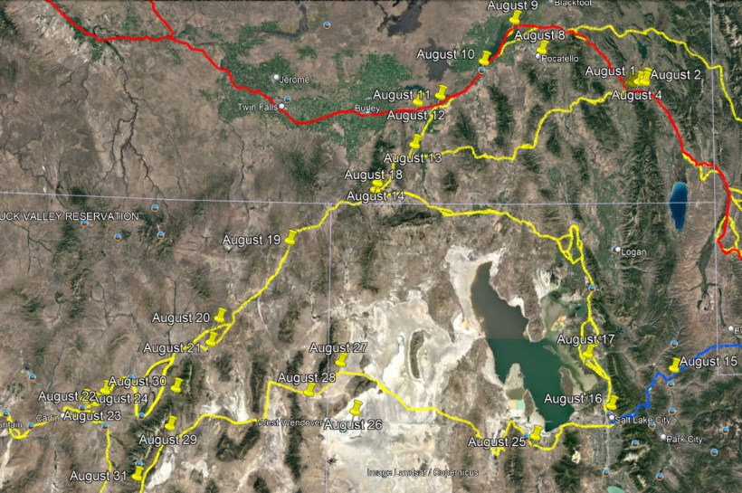
August 15 – A 5-month virtual road trip along the California Trail
Before we move on from City of Rocks (visited yesterday), we’re going to backtrack all the way back to Fort Bridger in Wyoming. As you may recall, we visited Fort Bridger (virtually) on July 26 and then headed north toward Fort Hall. Our other option was to take the road toward the Great Salt Lake and that’s what we’re going to explore now. We’ll return to the Fort Hall road in a few days. To get to the Great Salt Lake from Fort Bridger we must pass through the Wasatch Mountains. One of the canyons frequently mentioned in emigrant diaries is Echo Canyon (GPS coordinates -111.407, 40.990). Interstate 80 passes through the canyon and there are rest areas on either side of the freeway that have some interpretive information. You can read about the markers at the Historical Marker Database at https://www.hmdb.org/m.asp?m=125587 and https://www.hmdb.org/m.asp?m=67627. The accompanying photograph comes from the latter site.
William Lee (https://www.octa-journals.org/merrill-mattes-collection/journey-across-the-plains-williams-lee) was a soldier accompanying the Simpson topographical survey team mapping wagon routes across the Great Basin. On September 9, 1859 he wrote, “Marched 19 miles & camped on Echo Creek in Echo Cañon the road most of the time lay through a deep Canon with high mountainous hills on each side. I attempted to climb to the top of one with some of the party after coming to camp but failed met a wild kitten on my way up.”

August 16 – A 5-month virtual road trip along the California Trail
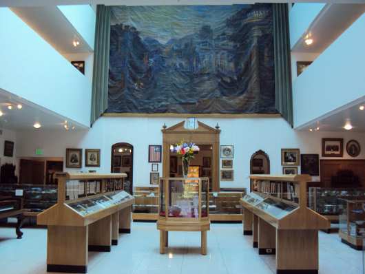
While in Salt Lake City, a must-see site for those interested in Trail History is the Daughters of Utah Pioneers Pioneer Memorial Museum (http://www.dupinternational.org/dyn_page.php?pageID=11 GPS coordinates -111.891, 40.777). The accompanying photograph is from that website which describes the museum as “the world’s largest collection of artifacts on one particular subject, and features displays and collections of memorabilia from the time the earliest settlers entered the Valley of the Great Salt Lake until the joining of the railroads at a location known as Promontory Point, Utah, on May 10, 1869.” Note that no photographs are allowed to be taken inside the museum.
There are plenty of emigrant diary descriptions of the city and people that settled in Salt Lake City. One example comes from William G. Johnston (https://babel.hathitrust.org/cgi/pt?id=njp.32101074863463&view=1up&seq=11) who wrote on June 23, 1849, “We had anxiously looked forward to reaching this place, where in addition to having much needed repairs done to the wagons, both men and animals could enjoy relaxation from severe toils, and recruit strength for others yet in store. Two days, it was thought, would be sufficient for these ends. We were not long in discovering that the good people of the town made our coming the occasion for a holiday. Scarcely were our tents pitched and the
mules let loose on the plains to look out for themselves, than a goodly company of men, women and children gathered about us, and salutations of welcome were extended. The accounts previously received concerning Mormons, especially while we had been in Missouri, had not led to the formation of favorable opinions in our minds, and an opportunity now seemed opening up to us by which, to some extent, we might be able either to confirm or revise these reports. If it were at all possible to base a correct opinion upon the intercourse had with many of them during our brief stay, it would only be just to say that we found ample reason to doubt the truth of much that has been said against them.”
August 17 – A 5-month virtual road trip along the California Trail
When emigrants got to the Great Salt Lake valley they were again faced with a route choice. In 1846 Lansford Hastings was promoting his “cutoff” as an improved way to get to California from Fort Bridger, rather than going by way of Fort Hall. We’ll explore that route starting on August 25. Many travelers from 1849 and onward chose to go via Salt Lake City so that they could re-supply and recuperate. Then, most of them would take the Hensley Cutoff around the east and north of the Great Salt Lake to re-connect with the California Trail near the City of Rocks. A marker describing the development of the route can be seen at GPS coordinates -112.069, 41.078. The photograph is from the Historical Marker Database at https://www.hmdb.org/m.asp?m=124032.
John Hawkins Clark (https://babel.hathitrust.org/cgi/pt?id=uc1.31822035077213&view=1up&seq=58&skin=2021) traveled this route in 1852. On July 23 he wrote, “Weber river five miles distant. Some of us left camp early to fish in that stream, but, like many a former effort to catch fish in these rapid running streams our enterprise was a failure. Weber river is quite a stream as it issues from the mountain gorge, but loses itself beneath the soil before reaching Salt Lake. Good farms and many improvements line the way of our journey; camp fifty miles north of Salt Lake city.”

August 18 – A 5-month virtual road trip along the California Trail
The Hensley Cutoff rejoins the Trail (GPS coordinates -113.718, 42.027) within the present-day boundaries of the City of Rocks National Preserve. The photograph is from the Historical Marker Database at https://www.hmdb.org/m.asp?m=123994. It is looking back (north) toward the Twin Sisters and is taken from the place where the Hensley/Salt Lake City road rejoins the California Trail.
A.J. McCall (https://babel.hathitrust.org/cgi/pt?id=uc1.31158005904320&view=1up&seq=80&skin=2021) described rejoining the trail from Salt Lake on August 7, 1849: “The morning was fine and cool for traveling. We saw a cloud of dust to the right of us, marking the great trail from Pacific spring to Fort Hall, the usual traveled route, which we struck in about 8 miles. We found ourselves once more in the midst of the great caravan. Our old companions from whom we parted a month ago, we learn are but slightly in advance of us, notwithstanding our extended detour to and long stay at Salt Lake. The road was quite hilly. We crossed a ridge [Granite Pass] and struck Goose Creek flowing north (an affluent of the Columbia river) and about twelve miles from the junction of the trails…. How times change and men change with them. I look in vain among the ragged grave and bronzed codgers, dragging themselves wearily along, for those dashing, sprightly and gay young fellows, full of song and laughter, whom I saw in the valley of the Blue, on the banks of the Platte, two months ago. Where have they gone and what has become of them?”

August 19 – A 5-month virtual road trip along the California Trail
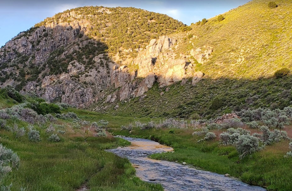
From City of Rock emigrants would pass over Granite Pass to reach Goose Creek, which they would follow upstream and then over a divide to enter the Great Basin. Rock Spring (GPS coordinates -114.376, 41.723) was a frequently mentioned landmark as travelers began their descent into Thousand Springs Valley. The photograph is from Wikimedia at https://commons.wikimedia.org/wiki/File:2014-10-20_11_25_20_Rock_Springs,_Nevada_along_Rock_Springs_Road_%28Elko_County_Route_763%29.JPG.
Margaret Frink (https://babel.hathitrust.org/cgi/pt?id=njp.32101079825640&view=1up&seq=103) described the region on July 19, 1850: “We started at half past six in the morning, and continued to travel up Goose Creek. The road was very rough. The face of the country presents volcanic appearances. At the last crossing of Goose Creek we broke our small wagon, which detained us an hour and a half. It was fourteen miles from this place to the next water. We reached it at five o’clock, at the entrance to Thousand Spring Valley. The spring was a beautiful one, flowing out from beneath a large rock. Four miles beyond this rock we encamped for the night. Here we traded some gun- powder for an antelope ham, with some friendly Indians of the Snake tribe. To-day, like yesterday, has been cloudy, with some sprinkling of rain. The Thousand Spring Valley, which we have just come into, takes its name from the great number of springs, both hot and cold, to be found in it. If all the tales we hear about it are true, it is an interesting place. At the farther end we expect to reach the head of the Humboldt River, which we have been told extends nearly to the California mountains. When we encamped in the evening, there being no grass near, the horses were taken some distance to the mountains, where good feed had been found.”

August 20 – A 5-month virtual road trip along the California Trail
When approaching the headwaters of the Humboldt River an alternate route developed which cutoff a corner of the Trial and bypassed the Humboldt wells (which we’ll visit virtually tomorrow). The road through the canyon was rough and rocky but it provided water along Bishop Creek and a hot spring (currently called 12-mile Hot Springs, GPS coordinates -114.947, 41.242). The photograph is from Google Maps of the Hot Spring area, which requires a high-clearance or 4-wheel drive vehicle to access.
James Bennet (https://babel.hathitrust.org/cgi/pt?id=mdp.39015012997295&view=1up&seq=78) passed through this canyon in 1850 and described, on August 19 and 20, “August 19 – … Here we expected to find grass, but were disappointed and continued on over the dividing ridge to Canyon Creek, ten miles further, where we encamped at ten o’clock at night, with a good supply of feed and water, having traveled twenty-eight miles. Canyon Creek is a tributary of Humboldt River. The soil here is very rich and the whole valley is covered with a luxuriant growth of grass and wild rye. The night was cold; a tin cup filled with water froze solid to the bottom. August 20 – Two miles down the creek brought us to another canyon and one of the toughest and most trying places on wagons I have seen. The canyon is five miles through; the road crossing the creek nine times. Three miles within the canyon are a number of boiling springs bursting from the base of the mountain immediately into the creek, rendering the water unfit for use for several miles below. We were put to some inconvenience in this respect at dinner time by not taking water above. We encamped on the creek, five miles below the canyon, having made twelve miles.”
August 21 – A 5-month virtual road trip along the California Trail
The Humboldt River is somewhat unique because its 300+ mile length has its beginning and end entirely within the confines of the Great Basin. In other words, it has no outlet to an ocean. I provided a westward navigational pathway (and water source) for emigrants as they made their way into the final stretch of their journey to California. Wells, Nevada takes its name from a set of springs that form a major source for the river. The GPS coordinates -114.971, 41.122 are for the springs themselves, which lie on private land. There are several Trail-related markers in the area that you can learn more about at https://www.hmdb.org/m.asp?m=138454, https://www.hmdb.org/m.asp?m=1373, and https://ctic.oncell.com/en/wells-278175.html. The photograph is from Google Maps along the Metropolis Road next to the Humboldt Wells.
On August 3, 1852 John Clark of Virginia (https://www.octa-journals.org/merrill-mattes-collection/a-pretty-fair-view-of-the-eliphent-charles-g-hinman-1849) wrote, “Here we camp on a grassy flat between two high mountains that are covered with snow. This evening is very cold, & we have hard work to gather sage brush & dry grass to burn. All the blankets are brot out & we are still cold. Here is several springs or deep wells on the flat. Plenty of small fish in them. To try the depth of one we took a log chain & made it fast to the end of lariets 120 long let it down but found no bottom. The water flows to the very top some are not more than three or four feet across, & if a steer slips in he is very easy to pull out. This is a very poor, barren country. A tree of any kind we have not seen for many days, not even a bush. This day only 7 graves, 33 broken down wagons, 49 head of dead stock.”

