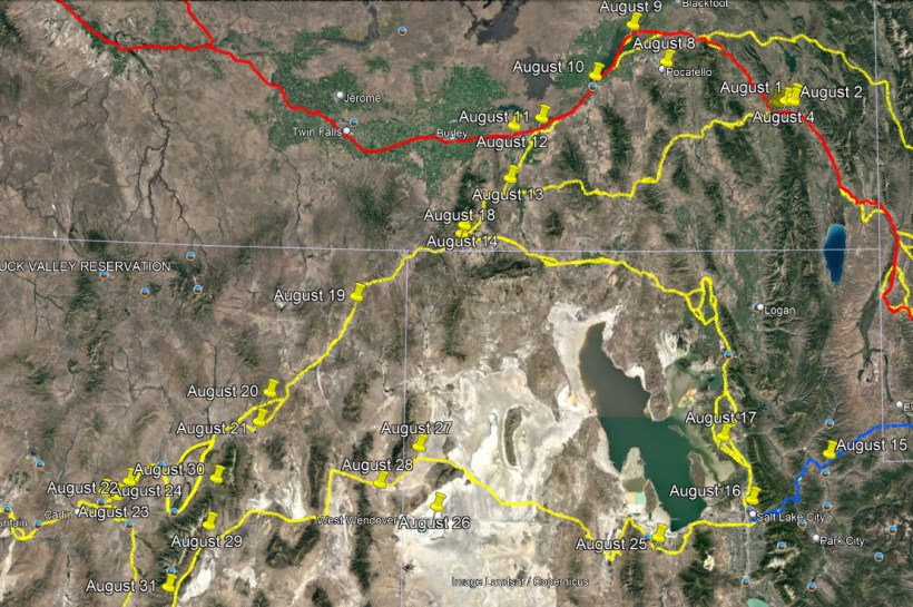
August 8 – A 5-month virtual road trip along the California Trail
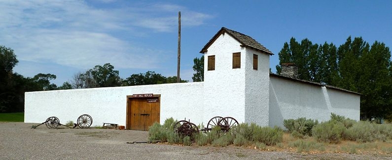
The Oregon and California Trails traveled up the valley where the towns of Bancroft and Chesterfield are, but there are no major highways that travel that route today. However, if you continue along Highway 30 you’ll branch off of the Hudspeth Cutoff and rejoin the Fort Hall road in the vicinity of Pocatello. Two of our posts are related to Fort Hall. There is a replica of the Fort in Pocatello (http://www.forthall.net/ GPS coordinates -112.420, 42.844) as part of the Bannock County Historical Museum. Tomorrow will visit the actual site. The website above has descriptions of what you will see at the replica site and also has a nice compilation of diary descriptions of Fort Hall. The Historical Marker Database has several pictures (including the one accompanying this post) and descriptions of the replica at https://www.hmdb.org/m.asp?m=108305.
W. F. Swasey (https://www.octa-journals.org/merrill-mattes-collection/early-days-and-men-of-california-w-f-swasey-1843) mentioned the Fort in his memoirs from 1843: “Early in June, with pack animals, we left Fort Laramie for Fort Hall via Fort Bridger. Fort Hall, now in Idaho, was then the headquarters or the Hudson Bay Fur Company. Some one hundred and fifty miles east of Fort Hall I discovered a Durham bull, wandering alone on the banks of a stream along which we were traveling, that had evidently been foot-sore and abandoned by some Oregon emigrant that had passed there. I found him well and in fine condition, and drove him in among our few loose animals, and from there to Fort Hall, as a legitimate prize, where he became a prime factor in assisting us on our journey to California, as well as a source of what promised to result in a serious difficulty. At Fort Hall I found a generous welcome from Captain Grant, then in charge there, to whom I had brought a warm letter of introduction from Colonel Hamilton, of Fort Laramie. When I informed him that we were going to California, he strenuously objected, saying that I was too young, and our party too small, to undertake it, and too little was known of the country intervening and the character of the different tribes of Indians that we would encounter. He urged his objections with almost paternal kindness, but I did not waiver in my determination to proceed, and he finally gave up the contest.”
August 9 – A 5-month virtual road trip along the California Trail
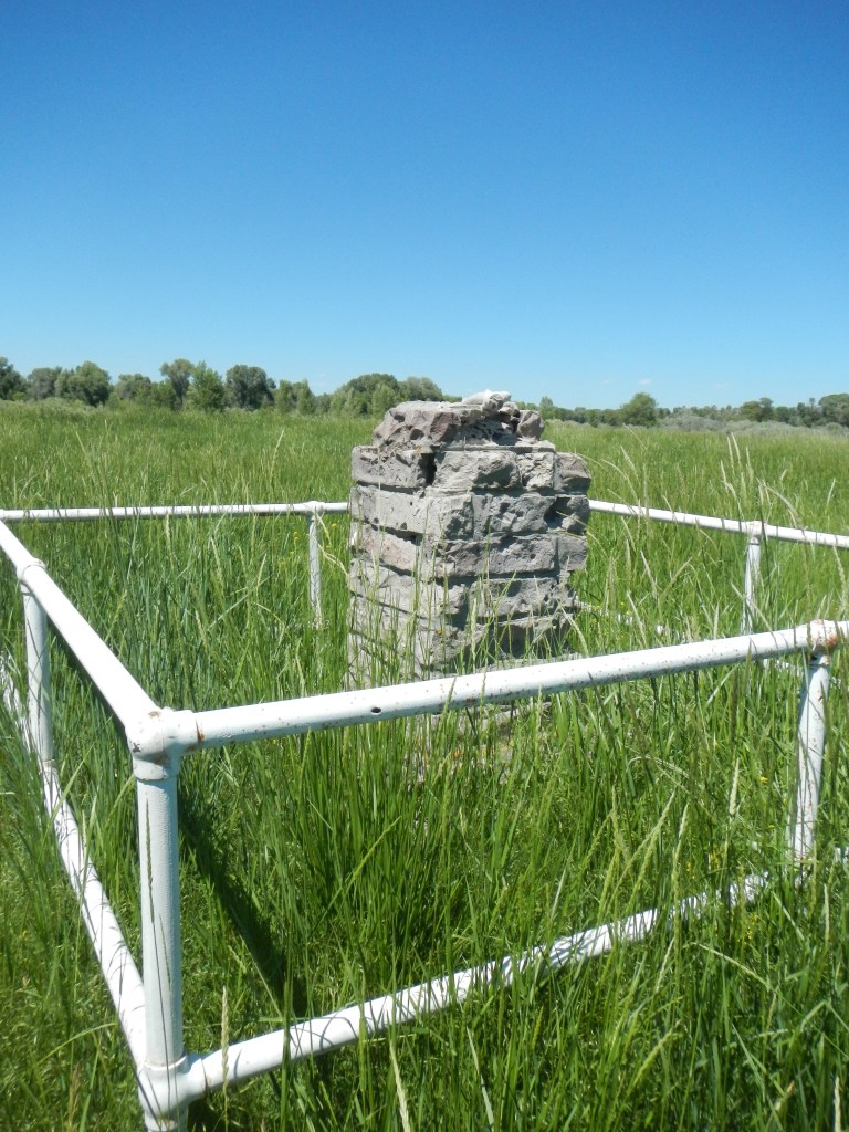
The actual Fort Hall Site (mentioned in yesterday’s post) lies on the Shoshone – Bannock Fort Hall reservation and requires permission from the tribal offices to visit (GPS coordinates -112.634, 43.020). The marker in the photograph is described in the Historical Marker Database at https://www.hmdb.org/m.asp?m=108309 along with other additional photos and details about the site. Another marker is located in the community of Fort Hall and described at https://www.hmdb.org/m.asp?m=124481.
Samuel Suffrins (https://www.octa-journals.org/merrill-mattes-collection/samuel-suffrins-october-31-1849) wrote, in 1849, “We reached the Fort on the 4th of July, at 3 o’clock, P.M. When we reached Fort Hall, having but one wagon and that being heavily loaded with the provisions and baggage, and the most arduous part of the journey yet to be undertaken and a number of the members of our company persisting in hauling the whole load through, our whole company commenced wrangling and quarrelling, until a dissolution was decided upon. A young man named O’Brien (from Cincinnati) and myself resolved to accomplish the remainder of our journey on pack mules. So we bought a couple of pack saddles, packed up a hundred pounds of provisions and our clothing – sold our wagon for $25 – jumped astraddle of a mule a piece and left Fort Hall on the 8th of July. The rest of the company packed also, but we left them behind.”
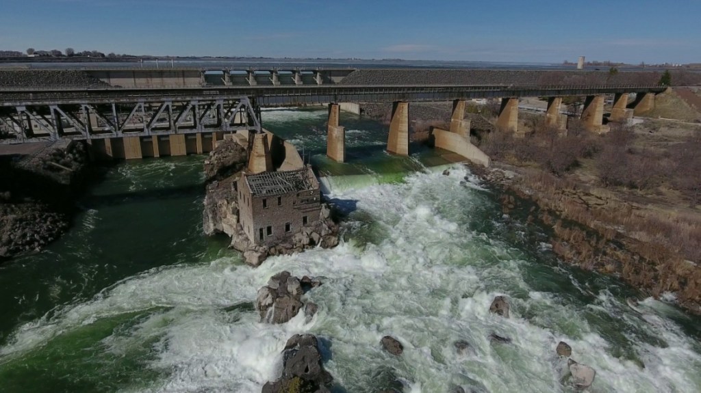
August 10 – A 5-month virtual road trip along the California Trail
The American Falls were noted by many emigrants traveling along the Trail. The falls have lost much of their original grandeur because of the construction in 1925 of the dam and hydroelectric facility. There are several historical markers in the vicinity commemorating the falls which are described on the Historical Marker Database at https://www.hmdb.org/m.asp?m=124074 and https://www.hmdb.org/m.asp?m=124140. The accompanying photograph is from the Idaho Fish and Game website at https://idfg.idaho.gov/blog/2020/05/anglers-are-reminded-special-fishing-regulations-snake-river-below-american-falls-dam and the GPS coordinates -112.875, 42.776 are probably the best place to see the overflow area (and sometimes falls in high water season) of the Snake River.
Margaret Frink (https://babel.hathitrust.org/cgi/pt?id=njp.32101079825640&view=1up&seq=84&skin=2021) desribed this area on July 13, 1850: “We started at five o’clock this morning, and soon came to the American Falls of Snake River. This stream, which is nine hundred feet wide, is inclosed between high walls of black, volcanic rock, and has a perpendicular fall of fifty feet. Beyond it is a wide plain of black lava, so broken and split with deep chasms that it can hardly be crossed by a man on foot. Fifty miles distant, northwest, the “Three Buttes” rise high and bold out of the lava plain, and can be seen for a long distance. Our first view of them was from the high ridge south of Fort Hall.” The Three Buttes Frink references would be part of Craters of the Moon National Monument (https://www.nps.gov/crmo/index.htm) today.
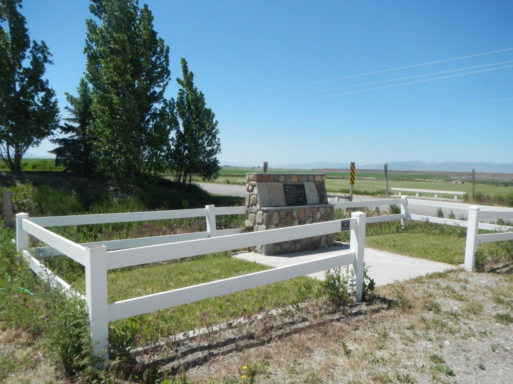
August 11 – A 5-month virtual road trip along the California Trail
It was at the point that the Raft River flowed into the Snake River that the true “Parting of the Ways” occurred. Here Oregon travelers continued to Oregon country and California travelers followed the Raft River south looking to locate the Humboldt River to lead them westward across the Great Basin. Heading south on Yale Road from Interstate 86 about 23 miles west of American Falls, you’ll encounter an interpretive marker (GPS coordinates -113.219, 42.577) described on the Historical Marker Database at https://www.hmdb.org/m.asp?m=123843. The accompanying photograph comes from that site.
Joshua Variel (https://www.octa-journals.org/merrill-mattes-collection/journal-of-joshua-variel) wrote on July 27, 1852, “Hot, thunderstorm at noon: Got a good start and travelled on, crossing gravel creek to camp near the road, 20 miles – good grass but no water. Stopped all night and started at sunup and came to the head branch of Raft R., 24 miles, after dark – grass and water good – had one bad hill to descend today and very long. Large quantities of sarvis berries on all the hills from Bear River here we could have camped 6 miles back at a spring but our Capt. got in a traveling mood.”
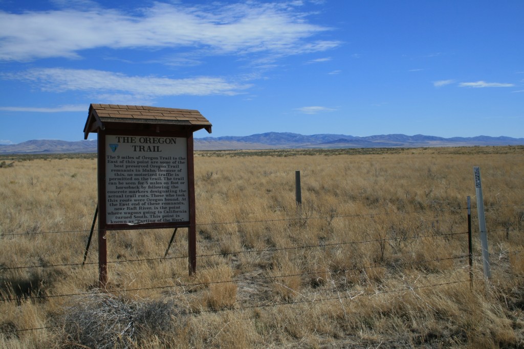
August 12 – A 5-month virtual road trip along the California Trail
We’ll quickly pay one final visit to the Oregon Trail. There is a seven-mile segment of Oregon Trail ruts still remaining relatively untouched on Bureau of Land Management controlled land (GPS coordinates -113.394, 42.544). No vehicles are allowed, but you can walk or ride horses along this segment back (east) toward the “Parting of the Ways” site visited yesterday. The photograph of the interpretive kiosk located next to the access road is from the Idaho National Historic Trails Auto Tour book available for download at https://www.nps.gov/articles/000/auto-tour-route-interpretive-guides-california-trail.htm.
Medoram Crawford (https://www.octa-journals.org/merrill-mattes-collection/diary-medorem-crawford-1842) described this stretch on August 22, 1842: “Started without breakfast and traviled verry fast until 8 o’clock stopped on a creek three hours. Started and drove on a trot nearly all day, verry rocky hard for horses feet. The same Barren Country covered with sage continues. Camped on a Little Brook at 5 o’clock traviled 30 m good water and grass, little wood suffered very much with dust.”
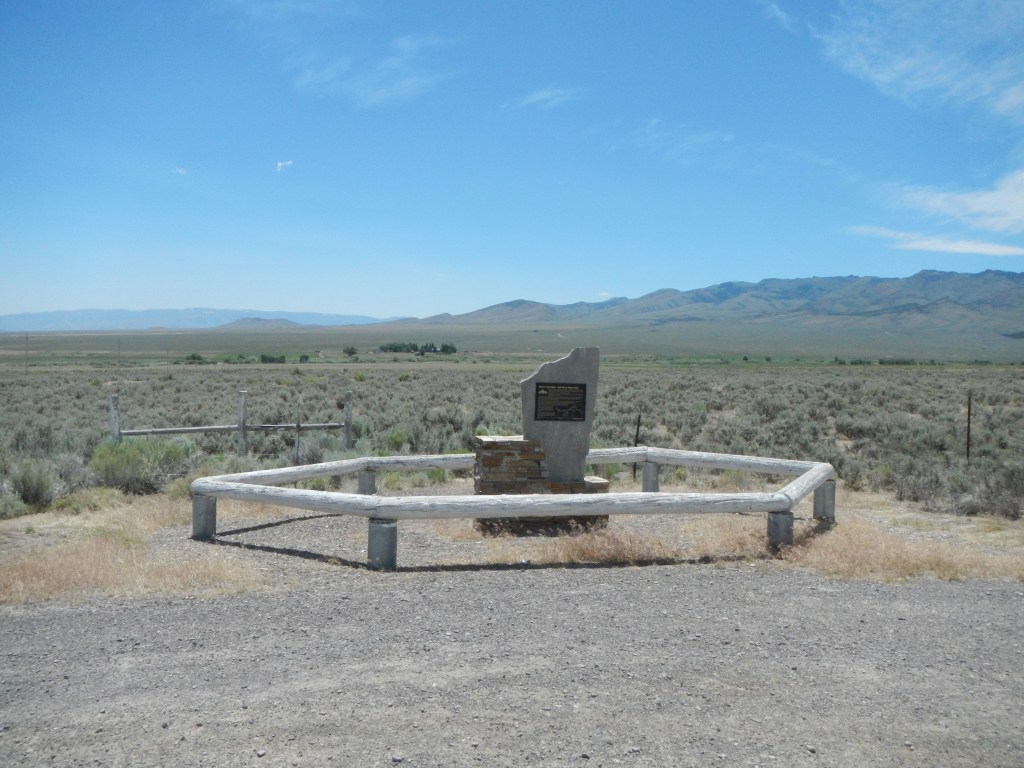
August 13 – A 5-month virtual road trip along the California Trail
Traveling south from the Snake River plain we reach the small town of Malta, ID. Highway 77 leaves town toward the southwest and approaches the point where the Hudspeth Cutoff (discussed on August 7) re-unites with the California Trail. There is an interpretive marker (GPS coordinates -113.424, 42.285) where Cassia Creek Road intersects with Highway 77. It describes all the trail segments in the region and the photograph is from the Historical Marker Database at https://www.hmdb.org/m.asp?m=123881. There is a Trails West T-Marker less than a half-mile southwest further down Highway 77 that marks where the California Trail crosses the highway, and the Hudspeth Cutoff joins the Trail less than a mile southwest of here.
Alonzo Delano (https://archive.org/details/lifeonplainsamon01dela/page/144/mode/2up) wrote on July 22, 1849, “Our traveling now became somewhat monotonous, with but little variation of scenery. One fact, however, was somewhat remarkable. Since leaving Green River we had heard of scarcely an accident from fire-arms. When we first crossed into the Indian territory above St. Josephs, every man displayed his arms in the most approved desperado style, and rarely thought of stirring from the train without his trusty rifle. But no enemies were seen. By degrees the arms were laid aside, and by the time we reached Fort Laramie all were abandoned except a knife, and sometimes a pistol, which might be seen peeping from a pocket. Our train soon left the valley of the Raft, at the point where I have since been told the new road from the Soda Springs, found by Myers, comes in. Turning up a small branch between high hills, we traveled all day in a small valley, the road ascending all the way, and night overtook us before we had gained the ascent of the ridge, where we found a spring, about a mile to the right of the road. We were looking with some impatience for that ‘good time coming,’ when we might catch a Leprechaun, or gold-giving spirit, scarcely doubting that we should eventually capture him. Distance, fifteen miles.”
August 14 – A 5-month virtual road trip along the California Trail
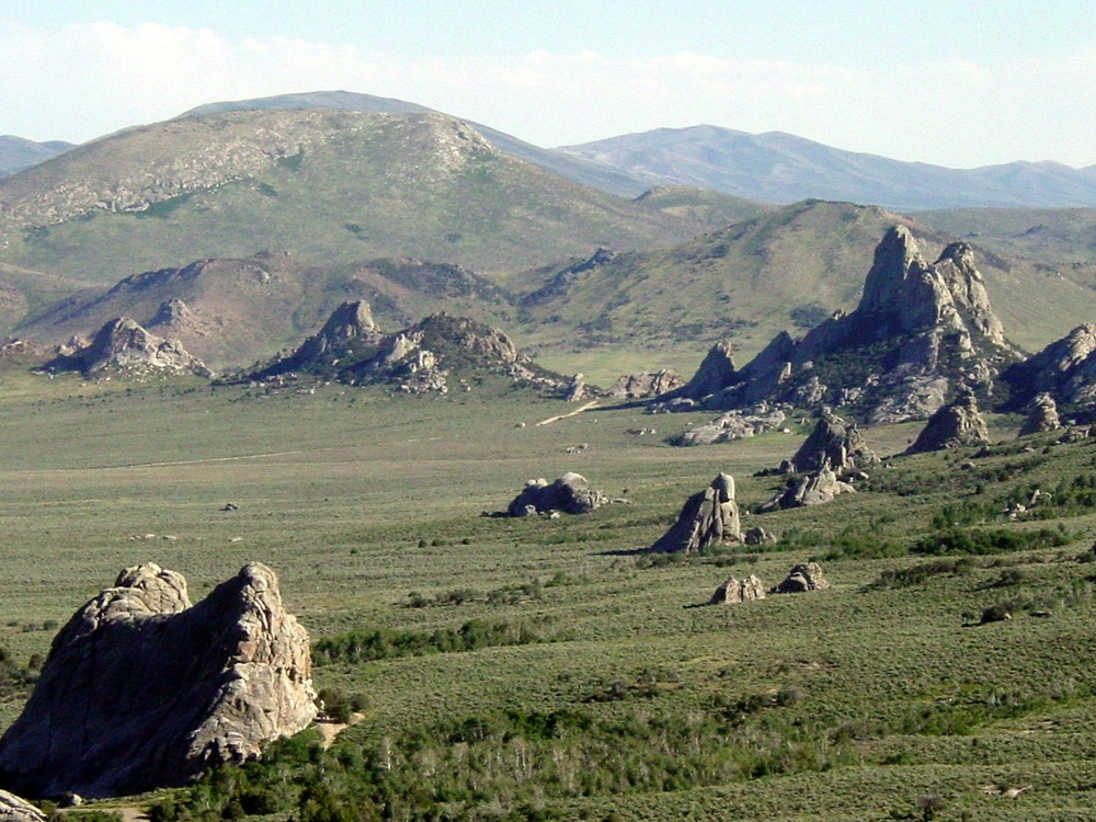
The City of Rocks National Reserve (https://www.nps.gov/ciro/index.htm GPS coordinates -113.702, 42.067) has its visitor center in Almo, ID and was a popular stop on the California Trail. Today it is popular with rock-climbing enthusiasts and campers. The photograph comes from this National Park Service website. You can also read about a number of the interpretive signs in the park at the Historical Marker Database starting with https://www.hmdb.org/m.asp?m=123994.
Helen Carpenter (https://www.octa-journals.org/merrill-mattes-collection/a-trip-across-the-plains-in-an-ox-wagon-helen-carpenter-1857) described the area on August 18, 1857: “Here we went into the mountains again, but had a very good road. Two miles farther, came to a narrow way which they call a pass. At the entrance of this, was a newly made grave, filled in with stones. Near it a bit of board was picked up, on which was written this brief account of the unfortunate one. ‘This man was killed by Indians, Aug. 7th. He was from Iowa, and was traveling alone with a wagon and one horse.’ Emerging from the pass, we came into what is known as Pyramid circle. There was perhaps an acre of partially level land, with a good sized stream flowing through it. On this level and the hills which encircled it, were the most beautiful and wonderful white rocks that we ever saw. This is known as the City rocks, and certainly bear a striking resemblance to a city. To be sure it was a good deal out of the usual, for the large and small house were curiously intermingled, and set at all angles, but it only made the place more charming. There was every thing one could imagine, from a dog house to a church and courthouse.”