July 15 – A 5-month virtual road trip along the California Trail
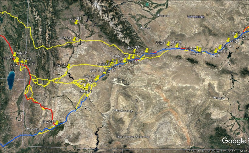
If you were traveling along the Sublette cutoff, you would reach the Little Sandy river at this point (GPS coordinates -109.302, 42.260). There are no modern roads through this region and the area is nearly unchanged from the days of the California Trail. You can read more about the crossings of the Little Sandy at https://www.wyohistory.org/encyclopedia/crossing-little-sandy-creek. The accompanying photograph comes from that site.
John Steele (https://babel.hathitrust.org/cgi/pt?id=uc1.31822042768408&view=1up&seq=13) wrote in his published diary regarding July 14, 1850 – “Taking Sublette’s Cut-Off, in six miles, over the same barren waste, and the sun beaming from a cloudless sky, we came to Little Sandy. Found good water, plenty of large willows, but no grass. Three large trains were camped here, several of their number being sick, some of mountain fever, and one serious case of cholera. We were told that grass could only be found by going a long distance up the river, and as I had been detailed to herd the oxen in the afternoon, and bring them in at night, I went out with the morning guard. We drove them several miles up the river, and found a wide valley, with an abundance of grass and willows. After the barren uplands, it was a kind of paradise for the oxen. George Matlock, the morning guard, had returned to camp, and late in the afternoon when rounding up the herd ready to return, the sound of a human voice arrested my attention. Passing in its direction, under the drooping branches of some tall willows, I found a man, apparently in the last stages of mountain fever. He was reclining on a blanket, raised a little from the ground by a pile of willow boughs, and talking in a low hollow tone. Without noticing my approach, he talked on, evidently laboring under mental derangement. There was such melancholy in his voice and features as he appealed to God for help or with deep pathos seemed addressing his wife, ‘I am so sorry, so sorry, but you know, darling, I want to help you.’ Then, as if addressing a comrade, ‘I’m sorry, Jim, I can’t go on, so sorry, so sorry.’ All so sad, every word and tone touched the heart. It was the ravings of delirium, but invested with an awful reality.”

July 16 – A 5-month virtual road trip along the California Trail
Continuing along the Sublette cutoff, you would reach the Big Sandy river at this point (GPS coordinates -109.413, 42.243). It was after this that you now faced a forty-mile stretch without water. WyoHistory describes the approaches to Big Sandy along both the Sublette Cutoff and the Fort Bridger route at https://www.wyohistory.org/encyclopedia/big-sandy-crossing. The accompanying photograph comes from that website, but is about 10 miles downstream from the Sublette cutoff crossing location.
Isaac Jones Wistar’s autobiography (https://www.google.com/books/edition/Autobiography_of_Isaac_Jones_Wistar_1827/y-vSkjjIszwC?hl=en&gbpv=1)
Included a copy of his journal during a trip to California during the Gold Rush. On July 2, 1849 he wrote, “Made only six miles to Big Sandy , a fine swift flowing creek , fifty yards wide and up to the wagon beds , with a good smooth bottom. We camped here to rest the stock and prepare to cross the “Jornada del Muerte,” a waterless desert extending fifty miles or more to the Green River of the Colorado. Repacked wagons , filled every vessel that would hold water, and overhauled the mules’ shoes and harness.”
July 17 – A 5-month virtual road trip along the California Trail
If you chose to avoid Sublette’s cutoff, you would cross the Little Sandy river at this point (GPS coordinates -109.347, 42.196). The Historical Marker Database (https://www.hmdb.org/m.asp?m=96697) has photographs of an old bridge (shown) and of a marker describing the crossing. Micajah Littleton (https://www.octa-journals.org/merrill-mattes-collection/journal-of-a-trip-across-the-plains-from-independence-missouri-to-california-m-littleton-1850) wrote on July 30, 1850, “Rolled out this Morning about 2 o’clk 6 miles brought us to the Junction of the Oregon road we here tooke the left hand it looks like many emigrants had passed on that rout. about 8 miles more brought us to Little Sandy here we thought we Should find grass but the emigracion has consumed all the grass within 3 and 4 miles of the road, and out Stock very much in want here at Little Sandy there is not a spear of grass within 4 miles and that there is lies amediately on the creek Little Sandy is a fine Stream some 20 or 25 feet wide and 2 feet or more deep running from the mountains curent rapid Sandy bottom and rather muddy. here the roads fork or Rather there are Some 2 or 3 roads…”

July 18 – A 5-month virtual road trip along the California Trail
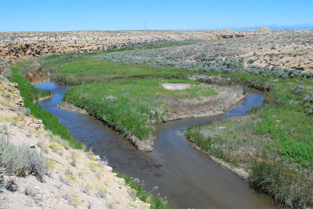
If you chose to avoid Sublette’s cutoff, you would cross the Big Sandy river at this point (GPS coordinates -109.452, 42.108). From here you would continue following the Big Sandy to its junction with Green River. The Historical Marker Database (https://www.hmdb.org/m.asp?m=47136) describes both a Big Sandy marker and a Little Sandy marker at this location on highway 28 southwest of Farson, WY. Both markers are visible in the accompanying photograph from that website.
In his journal on July 18, 1850 John Wood (https://archive.org/details/GR_4732/page/n37/mode/2up) wrote,”This is Monday morning, which finds us on our sickly course to the promised land. We are now about two thousand miles from our homes, on our way down the western side of the Rocky Mountains, and over one thousand miles from California, and we cannot, or dare not say as Bonaparte did before he crossed the Alps, “is the route practicable,” but we must push on and see for we cannot retrace our steps. Mountains rise high before us and long deserts lie between us and our western home, and they must be crossed or we perish in the wilderness, but we have some friends who are gone before and we are determined to follow on. The road to-day was awful dusty but not very stony; we traveled five miles and reached a creek, called Big Sandy, where we camped in a beautiful bottom, and found grass for the stock, about three miles south of the road. We have had no rain for a long time, not since we left the Platte Bottom, I believe. The weather is cool of nights, yet pleasant during the day. Mr. Pucket is near his last, death seems to follow us. All is still and solemn this morning, for the work of death is seen; David Pucket is no more; he died this morning, just before day and was burried at 7 o’clock, on the banks of Big Sandy, ten miles east of Green river. No relative was there to shed a tear over his grave; he was quite a youth and certainly was an exception to human nature. He told me, a short time before he died, that he had always succeeded in doing what he conceived to be right, that he had started to California to get money enough to educate himself, that he might be useful in the world, and that he did not regret the least that he had to die for he was going to heaven. Oh, what a source of consolation this must be to his bereaved parents. Before he died his request was that all should attend his burrial, so all did that could, and when he was laid in the grave, Mr. More read one of the Psalms of David, sung a hymn and prayed for the living, and when the grave was covered o’er we returned to camp, with sadened hearts. Man cannot become familiar with such scenes.”
July 19 – A 5-month virtual road trip along the California Trail
Along this portion of the Trail, the Oregon and California and Mormon Trails are still coinciding. During the years of emigrant travel there were sometimes tensions among groups – tensions relating to provisions, security, and even religion. Simpson’s Hollow (GPS coordinates -109.5907387478312, 42.01817300966624) is a spot where tensions were focused not so much on the emigrants, but on tensions between the U.S. Government, Army, and Utah/Mormon settlers. It was at this site that wagons belonging to the U.S. Army were sabotaged and burned by local settlers. You can see descriptions of several markers (and this accompanying photograph) on the Historical Marker Database at https://www.hmdb.org/m.asp?m=67038. You can also learn more about this site at https://www.wyohistory.org/encyclopedia/simpsons-hollow-flash-point-utah-war.
William A. Carter (https://archive.org/details/annalsofwyom11141939wyom/page/106/mode/2up) was traveling this route in 1857 and noted the following in his journal: “We are now near the place where one of the trains was burned on Big Sandy. November 14th – The day broke with thick clouds of cold frost and mist hanging along the horizon and flying through the air, but before we were ready to start the sun came forth with unusual brightness spangling the air with myriads of glistening particles. Our road led down Sandy over a smooth sandy surface for 3 miles before it came into the main track — We crossed the stream on the ice and proceeding about 10 miles descended into a small Valey and came suddenly upon the smouldering ruins of 26 wagons which were corralled on each side of the road when burned by the Mormons. The Big Sandy makes a considerable circle to the south west and empties into Green River not a great distance from where we cross it.”

July 20 – A 5-month virtual road trip along the California Trail
The Pilot Butte Interpretive Pullout site on Highway 28 twelve miles southwest of Farson, WY (GPS coordinates -109.623, 41.998) has 8 interpretive signs placed by the Bureau of Land Management. The Historical Marker Database has links to descriptions of all of them at https://www.hmdb.org/m.asp?m=67047 and the accompanying photograph came from that site as well. You’ll learn about Pilot Butte itself, the first Transcontinental Railway, death on the Trail, emigrant & native relations, and grave sites and burials.
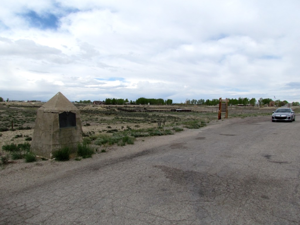
Howard Stansbury, in his Exploration and Survey of the Valley of the Great Salt Lake of Utah in 1850 (https://archive.org/details/explorationsurve00stan/page/230/mode/2up) was traveling east through this region. On September 12 he wrote, “Last night was very cold, and at sunrise the thermometer stood at 22°. Shortly after leaving camp we ascended a hill opposite the mouth of the Muddy, and reached a remarkable isolated butte, to which the traders have given the name of “The Church.” It is composed of green and brown indurated clay and brown sandstone, seamed and furrowed by the elements into fantastic and picturesque forms, resembling somewhat the ruins of a huge antiquated castle. Following the old road for a couple of miles farther, over a level country of sand and clay, almost denuded of vegetation, except occasional patches of artemisia, which seems to claim as its peculiar property soil where nothing else will grow, we came in sight of a high butte, situated on the eastern side of the Green River Valley, some forty miles distant: a landmark well known to the traders, and called by them Pilot Butte. Leaving the emigrant road here, we struck for this prominent elevation, passing, on our way to it, over a barren plain formed by the washings from the hills, which had covered up every vestige of vegetation, and presented an aspect of dreary desolation saddening to the heart. “
July 21 – A 5-month virtual road trip along the California Trail
The next major landmark on our virtual road trip would be Green River. However, all routes will cross Green River, including the Salt Lake road, Sublette’s Cutoff, and another road that we haven’t explored yet – the Lander Cutoff. Originally called the Fort Kearney, South Pass, and Honey Lake Wagon Road, it was the first U.S. Government-sponsored road planned by Frederick William Lander. Before reaching Green River, we’re going to backtrack prior to the “Parting of the Ways” and Sublette Cutoff (see the July 14 Facebook post) to the point where the Lander Cutoff leaves the main road. The wagon track following the Lander Cutoff (GPS coordinates -109.658, 42.626) can be viewed in a pullout off of Highway 191 about 35 miles northwest of Farson, WY. The Lander road was opened in 1859 for emigrants on the Oregon and California Trails. There are five interpretive signs in this pullout. The WyoHistory website has a good article about the development of the Lander Road at https://www.wyohistory.org/encyclopedia/lander-trail-national-road-building-comes-wyoming. The photograph of the wagon tracks came from a Google Earth user and was downloaded from https://lh5.googleusercontent.com/p/AF1QipN7ruUYiE1T4sSDWAmzee1iWHP9n7SnQpOg3GDz=w2560-h1440-pd.
In the Lander report (https://digitalcommons.law.ou.edu/cgi/viewcontent.cgi?article=8798&context=indianserialset) a group of over 9,000 emigrants signed off on the following statement – “We, the undersigned, emigrants to California and Oregon, having just passed with our wagons and stock over the new government road, from the South Pass to Fort Hall, (called Lander’s cut-off,) do hereby state that the road is abundantly furnished with good grass, water, and fuel; there is no alkali and no desert as upon the old road, and while upon it our stock improved and rapidly recovered from sickness and lameness. We were much surprised at the great amount of labor that had been done in cutting out the timber and bridging and grading the road, and in all respect it more than met our expectations, especially those of us who have heretofore travelled the other routes. But we would most respectfully suggest that a bridge should be erected, as soon as possible, over Green river, the fording of which is dangerous and the cause of much trouble to the emigration, and in one instance the loss of life.”

