July 8 – A 5-month virtual road trip along the California Trail
There is a pullout (GPS coordinates -108.009, 42.517) on Highway 287 west of Jeffrey City that has a historical marker regarding an Ice Slough. Emigrants discovered that this particular valley has a marsh which maintains ice at depth well into the summer and they often enjoyed harvesting the ice to use in their drinks and for meat preservation. The Wyoming Historical Society webpage WyoHistory (https://www.wyohistory.org/encyclopedia/ice-slough-novelty-oregon-trail) has a good article about this feature. The photographs are available from the Historical Marker Database at https://www.hmdb.org/m.asp?m=62076.
Dr. William Thomas (https://www.octa-journals.org/merrill-mattes-collection/diary-of-dr-william-thomas-1849) described it this way: “June 16, 1849 – … just before we encamped I discovered a herd of elk and being very desirous of killing one left the train on foot pursuing them. I must have traveled eight miles before I caught up with our waggon, and the worst of it was did not get close enough to even shoot at them- They practice deception remarkably well will stand and look at you until they think danger approaching when they bounce off and away they go. After jumping some two or three hundred yards they stop and look at you until you get about the same distance as before when the same thing is repeated. I was so vexed at them that I almost determined to swear enmity to the whole race and devote my time from here to California exclusively to hunting elk. This evening after crossing a sandy thoug elevated plaine we came to a most beautiful valley which had the appearance of having a swampy marshy streak extending its whole length through its center. The grass in which was tall green and thick Some of our men in endeavoring to find water cut about 15 inches through the sod struck a hard substance, and upon examination, found as pretty Ice as ever was seen. The whole valley appears to be covered with thick layer of ice and then one of sod- we gathered several bucketts full from which we have had mint julips in abundance-

July 9 – A 5-month virtual road trip along the California Trail
The 6th Sweetwater Crossing (GPS coordinates -108.183, 42.542) is also a site of Mormon Handcart troubles. This site, like Martin’s Cove (discussed on July 6) is operated by the Church of Jesus Christ of Latter Day Saints (https://www.churchofjesuschrist.org/learn/historic-sites/wyoming/sixth-crossing?lang=eng) and has a visitor center and a road to the actual 6th crossing location. The accompanying photograph comes from that website.
Diarist John Chislett (https://familysearch.org/patron/v2/TH-301-46171-171-82/dist.pdf?ctx=ArtCtxPublic) related the arrival of rescuers and supplies during the Willie Company’s entrapment during an October snowstorm. October 21, 1856 – “On the evening of the third day after Captain Willie’s departure, just as the sun was sinking beautifully behind the distant hills, on an eminence immediately west of our camp several covered wagons, each drawn by four horses, were seen coming towards us. The news ran through the camp like wild fire, and all who were able to leave their beds turned out enmasse to see them. A few minutes brought them sufficiently near to reveal our faithful captain slightly in advance of the train. Shouts of joy rent the air; strong men wept till tears ran freely down their furrowed and sun-burnt cheeks, and little children partook of the joy which some of them hardly understood, and fairly danced around with gladness. Restraint was set aside in the general rejoicing, and as the brethren entered our camp the sisters fell upon them and deluged them with kisses. The brethren were so overcome that they could not for some time utter a word, but in choking silence repressed all demonstration of those emotions that evidently mastered them. Soon, however, feeling was somewhat abated, and such a shaking of hands, such words of welcome, and such invocation of God’s blessing have seldom been witnessed. I was installed as regular commissary to the camp. The brethren turned over to me flour, potatoes, onions, and a limited supply of warm clothing for both sexes, besides quilts, blankets, buffalo-robes, woollen socks, etc. I first distributed the necessary provisions, and after supper divided the clothing, bedding, etc., where it was most needed.”
July 10 – A 5-month virtual road trip along the California Trail
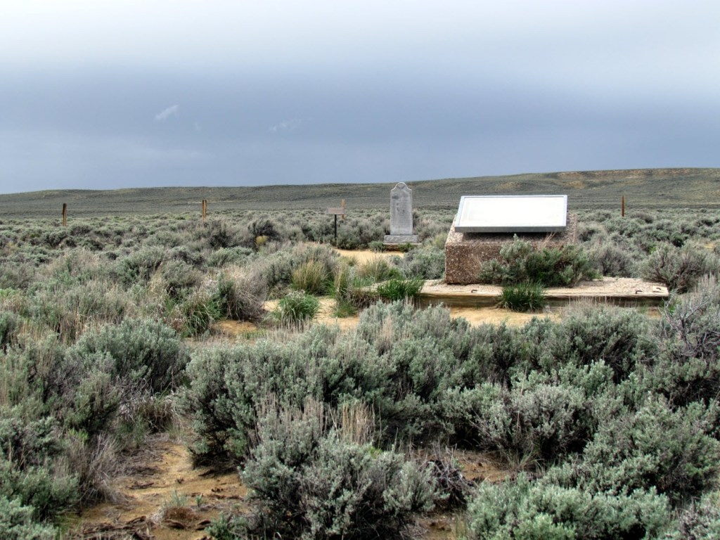
Rock Creek Hollow (https://www.churchofjesuschrist.org/learn/historic-sites/wyoming/rock-creek-hollow-mormon-trail-site?lang=eng GPS coordinates -108.624, 42.440) is the third site operated in this region by the LDS church regarding the Mormon Handcart 1856 winter troubles – see the July 6 and July 9 posts regarding the other two. It is the site where the Willie handcart company sheltered in place after ascending Rocky Ridge during the October, 1856 snowstorm. 15 people had frozen and died during the storm.
Diarist John Chislett (https://familysearch.org/patron/v2/TH-301-46171-171-82/dist.pdf?ctx=ArtCtxPublic) continued his harrowing account on October 24 with a description of the dreadful burials at Rock Creek Hollow: “There were so many dead and dying that it was decided to lie by for the day. In the forenoon I was appointed to go round the camp and collect the dead. I took with me two young men to assist me in the sad task, and we collected together, of all ages and both sexes, thirteen corpses, all stiffly frozen. We had a large square hole dug in which we buried these thirteen people, 3 or 4 abreast and 3 deep. When they did not fit in, we put one or two crosswise at the head or feet of the others. We covered them with willows and then with the earth. When we buried these thirteen people some of their relatives refused to attend the services. They manifested an utter indifference about it. The numbness and cold in their physical natures seem to have reached the soul, and to have crushed out natural feeling and affection. Had I not myself witnessed it, I could not have believed that suffering would have produced such terrible results. But so it was. Two others died during the day, and we buried them in one grave, making fifteen in all buried on that campground.”
July 11 – A 5-month virtual road trip along the California Trail
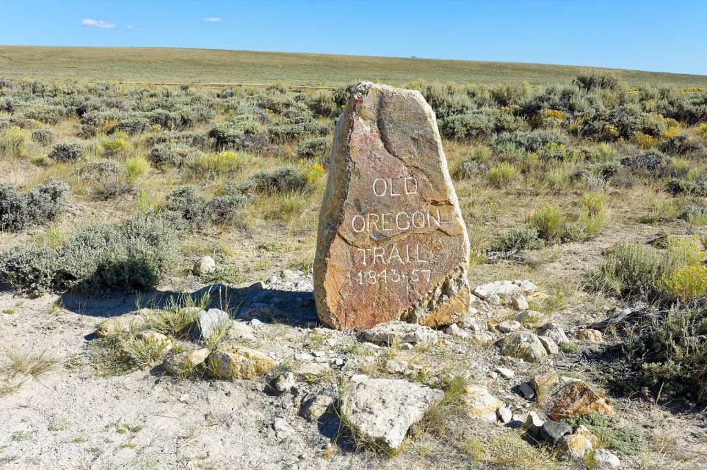
South Pass! The long-anticipated pathway across the Rocky Mountains! So many emigrants reached this point and marveled at the relative ease with which they were able to cross it. The GPS coordinates (-108.887, 42.343) mark the actual summit point but no modern highway passes exactly through this spot. The photo from a Google Earth user (https://lh5.googleusercontent.com/p/AF1QipPKeKEJOKFTtpweqPL0Q4-OUpC28rAegf7Lvhpq=h1440) shows a stone marker placed there in 1906 by famed Oregon Trail pioneer Ezra Meeker. According to the Historical Marker Database (https://www.hmdb.org/m.asp?m=80503), “Located at the summit of South Pass, the simplicity of this marker belies its significance in preservation of the Oregon Trail. The marker was placed there in 1906 by Ezra Meeker. Earlier, in 1852, Meeker and his wife had made their way from Ohio to Oregon Territory on the trail. … In 1906 he began an effort to mark significant spots along the Trail. Until then there were only twenty-two monuments on the route. Meeker’s campaign took the form of traveling from Puget Sound to Independence Missouri (west to east) by covered wagon pulled by oxen. Beginning in March, he reached South Pass in mid-June where he erected the marker above.
In his book, Ox-Team Days (https://www.google.com/books/edition/Ox_team_Days_on_the_Oregon_Trail/MkF6AAAAMAAJ?hl=en&gbpv=0
) he described the placement of the marker: “On June 22 we were still camped at Pacific Springs. I had searched for a suitable stone for a monument to be placed on the summit of the range, and, after almost despairing of finding one, had come upon exactly what we wanted. The stone lay alone on the mountain side; it is granite, I think, but mixed with quartz, and is a monument hewed by the hand of Nature. Immediately after dinner we hitched the oxen to Mr. Halter’s wagon. With the help of four men we loaded the stone, after having dragged it on the ground and over the rocks a hundred yards or so down the mountain side. We estimated its weight at a thousand pounds…. The letters were then cut out with a cold chisel, deep enough to make a permanent inscription. The stone was so hard that it required steady work all day to cut the twenty letters and figures.”
July 12 – A 5-month virtual road trip along the California Trail
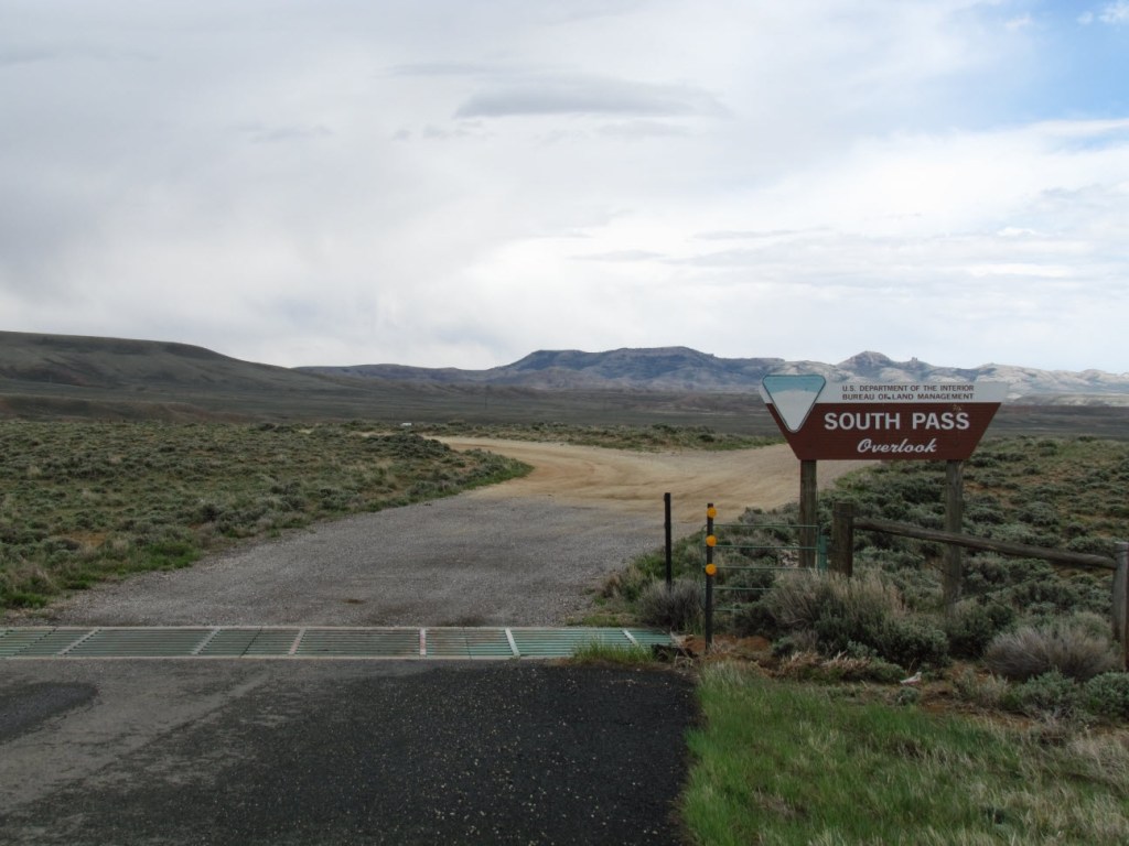
There is a pullout off of Highway 28 near South Pass (GPS coordinates -108.973, 42.330) with a number of interpretive signs regarding South Pass and the overland exploration and emigration. The Historical Marker Database (https://www.hmdb.org/m.asp?m=67021) describes six different interpretive signs at this Bureau of Land Management Overlook and the photograph came from that website. You can travel on dirt roads beyond this pullout to another popular nearby site, Pacific Springs, at which you’ll find another interpretive sign (GPS coordinates -108.946,42.333).
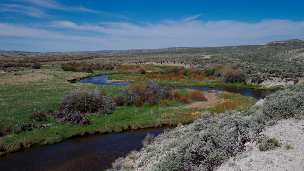
In his memoir of 1849, Hermann B. Scharmann said, “From Fort Laramie to the South Pass the land is only sparsely covered with grass, in altogether insufficient quantity for the countless crowds of emigrants that must pass over it. In addition to this, the road is rough and rocky, although it passes between the mountains instead of over them. Finally, without any climbing, the South Pass is reached. There a brook splashes merrily over the rocks and a good-sized grassy expanse greets the traveller’s weary eyes. The brook is called Pacific Creek. On my arrival I found five thousand oxen and numerous mules and wagons, besides their human owners. These separated here, some to go to the Mormon City, others to join the California travellers. I attached myself to this latter division and so had plenty of company.”
July 13 – A 5-month virtual road trip along the California Trail
Continuing southwest down Wyoming Highway 28 you’ll encounter another pullout on the north side of the road. The interpretive markers here all talk about the Parting of the Ways, which in reality is located at another point (to be discussed tomorrow). So, I’ll refer to this one as the “False Parting of the Ways” (GPS coordinates -109.059, 42.285). You can see it described on the Historical Marker Database at https://www.hmdb.org/m.asp?m=67035.
Aaron W. Harlan (https://archive.org/details/overlanddiarieso00deanrich/page/48/mode/2up) recorded in his diary from July 11 and 12 regarding the region before and after crossing South Pass: “July 11 – white frost this morning, forenoon warm, after noon windy, there are many pretty flowers in bloom, we have laid by all day & doctored and grazed our oxen, our elevation is so great that the rays of light from the sun are visible all the night, horned toads are plenty July 12 – more frost, we left our encampment late in the day & crossed through the pass, this appears to have been in some age of the world a mass of lime stone interveneing between the granite formations & the whole has been burned, the lime has gradually leached away & settled down, forming these salaratus lakes & alkalie water & furnishing the material to support the coral insects & build up the reefs of florida and the west indies, about the Pacific Springs the ground was literally strewed with dead cattle & horns, say 100 within 1 mile.”
July 14 – A 5-month virtual road trip along the California Trail
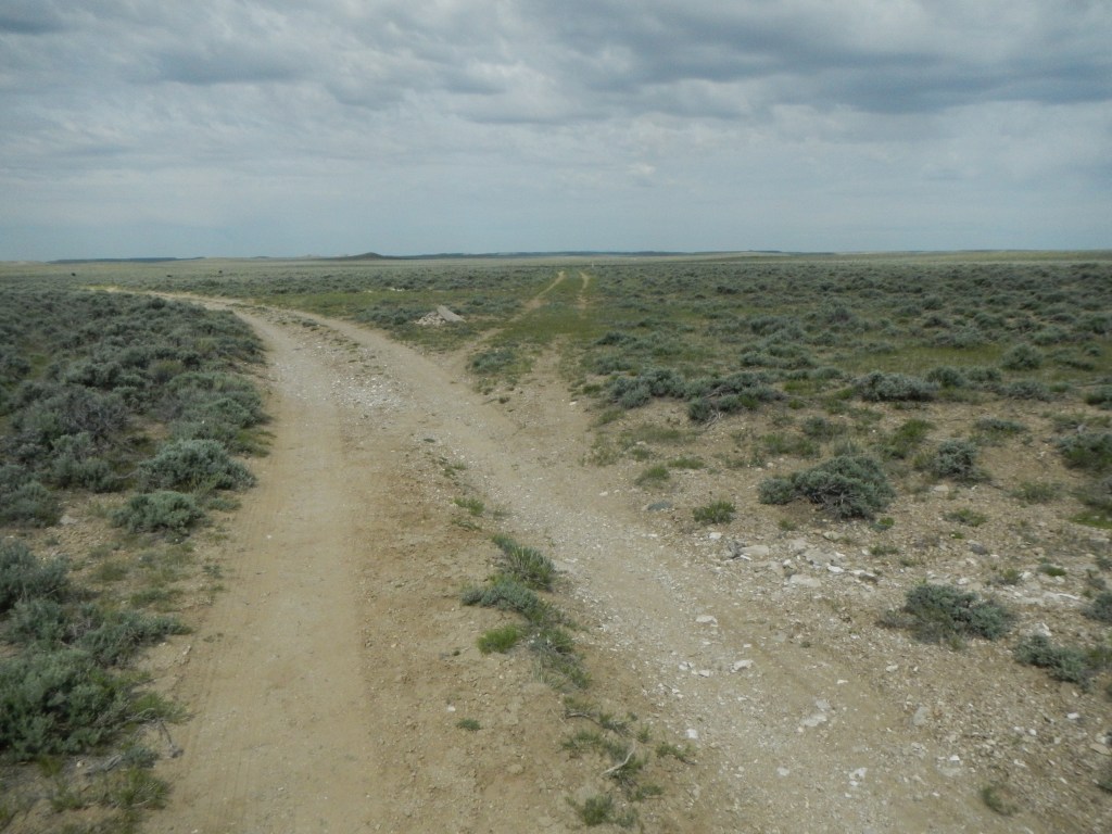
The road following Sublette’s Cutoff toward Fort Hall (in present-day Idaho) branches off the trail at this point (GPS coordinates -109.228, 42.258). This was a “cutoff” which shortened the route by several days but involved passing across a forty-mile desert without water. The older trail, by way of Fort Bridger and/or the Great Salt Lake Valley, continues to the left. You can read more about this split at the Wyoming Historical Society website WyoHistory (https://www.wyohistory.org/encyclopedia/parting-ways). The photograph above and a description of an interpretive sign at the parting site can be found at the Historical Marker Database (https://www.hmdb.org/m.asp?m=96684).
Elisha Douglass Perkins wrote, on July 25, 1849, “At the forks of the regular road & where Subletts cutoff leaves by[passing] Ft Bridger I saw some 40 or 50 notes stuck up in forked sticks with directions and news &c. from those in advance to acquaintances behind, none however from anyone I knew. This kind of post office is very common at the different points on the road & I have never known an instance of any note or scrap of paper being disturbed or misplaced. Every person looks to see who they are from & goes on leaving all as he finds it.” Perkins’ published diary can be previewed at https://www.google.com/books/edition/Gold_Rush_Diary/xoIwEAAAQBAJ?hl=en&gbpv=1, but the preview does not have this entry in it.