May 15 – A 5-month virtual road trip along the California Trail
There were many streams like Elm Creek (GPS coordinates -96.612, 39.732) which had to be crossed in this area. But streams weren’t the only thing on the minds of the emigrants. While passing through this region, Harlow Chittenden Thompson (https://www.octa-journals.org/merrill-mattes-collection/harlow-chittenden-thompson-across-the-continent-on-foot-in-1859), in 1859, wrote, “Day in and day out our diet seemed to be about the same. We had a small sheetiron stove with an oven and a lid on top. With this our bread was baked and our bacon fried. For breakfast we usually had hot bread, bacon and coffee, also what was called “dope” used with our bread in the place of gravy or butter. Parker used to make it by browning some flour in the bacon fat and then add water and flour to thicken it, having it about as thick as heavy paste. Our supper was usually the same with perhaps the addition of applesauce or boiled rice and sometimes cold beans. At noon we always had cold bread and cold beans seasoned with a bit of bacon and perhaps some apple sauce or hard tack, these articles having been prepared by Parker the evening previous, as no cooking was done at noon time. Talk about good living, and appetizing food! No one, unless he has passed through such an experience, can imagine how good that food tasted and how we enjoyed it. The amount we seemed to get out side of was simply amazing. No indigestion, no discomfort but always ready for the next meal. Parker always claimed it was owing to his knowledge of cooking. Later on we occasionally had a Jack rabbit or a sage hen, which the shotgun enabled us to get. Of course it was enjoyed as a change; still the sage hens usually tasted so strongly of the wild sage upon which they lived that we soon tired of them and much preferred a few slices of bacon.” The photo is from the Plains exhibit in the California Trail Interpretive Center.

May 16 – A 5-month virtual road trip along the California Trail
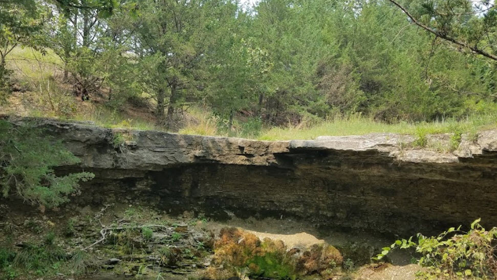
Alcove Spring (GPS coordinates -96.675, 39.749) is a well-known landmark on the Trail. It was named by Edwin Bryant (https://archive.org/details/whatisawincalifoin00brya) on May 27, 1846 – “About three-fourths of a mile from our camp we found a large spring of water, as cold and pure as if it had just been melted from ice. It gushed from a ledge of rocks, which composes the bank of the stream, and falling some ten feet, its waters are received into a basin fifteen feet in length, ten in breadth, and three or four in depth. A shelving rock projects over this basin, from which falls a beautiful cascade of water, some ten or twelve feet…. We named this the ‘Alcove Spring’ and future travellers will find the name graven on the rocks, and on the trunks of the trees surrounding it.” The photograph is from Google Maps Streetview.
Two days later Bryant related the death of Sarah Keyes of the famed Donner/Reed Party. “Last night Mrs. Sarah Keyes, a lady aged 70, a member of the family of Mr. J. H. Reed of Illinois, and his mother-in-law, died. Mr. Reed, with his family, is emigrating to California. The deceased Mrs. Keyes, however, did not intend to accompany him farther than Fort Hall, where she expected to meet her son who emigrated to Oregon two or three years since. Her health, from disease and the debility of age, was so feeble, that when she left her home, she entertained but faint hopes of being able to endure the hardships of the journey. Her physicians had announced to her that she could live but a short time, and this time she determined to devote to an effort to see her only son once more on earth. Such is a mother’s affection! The effort, however, was vain. She expired without seeing her child. The event, although it had been anticipated several days, cast a shade of gloom over our whole encampment…. At 2 o’clock, p.m., a funeral procession was formed, in which nearly every man, woman, and child of the company united, and the corpse of the deceased lady was conveyed to its last resting-place, in this desolate but beautiful wilderness…. The inscription on the tombstone, and on the tree beneath which is the grave, is as follows: ‘Mrs. Sarah Keyes, Died May 29, 1846: Aged 70.'”
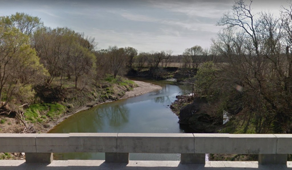
May 17 – A 5-month virtual road trip along the California Trail
The crossing of the Big Blue River (GPS coordinates -96.684, 39.747) lay adjacent to Alcove Springs (discussed in yesterday’s post). Henry S. Hamilton (https://www.octa-journals.org/merrill-mattes-collection/reminiscences-of-a-veteran-henry-s-hamilton-1857) was part of a military regiment heading to Salt Lake City in 1857. He wrote, “After a few days’ marching we came to the Big Blue river. It had quite a belt of timber along its banks, and, strange to say, was alive with pigs and hogs of every size; in fact, the ‘woods were full of them.’ Some of us determined upon a change of diet, by substituting fresh pork for salt. After pitching the tents, we sallied forth in quest of the porkers. Very soon the air resounded with the din of small arms, and from every direction the men could be seen issuing from the woods and hurrying to camp with little pigs and big pigs on their backs and under their arms. I fortunately secured three small ‘Berkshires,’ which I skinned, also cutting off their heads and feet, before bringing them in; while Carl Myers, a German member of the band, brought in two just as he shot them. Now it so happened that an old squatter, who lived some distance away, upon hearing the noise of our revolvers came running to camp and claimed that the pigs were his, which was much doubted, as they were as wild as buffalo; but he went straight to headquarters and complained to the colonel of this wanton destruction of his property. He made the commanding officer believe his story, and even accompany him in his search among the tents. Everywhere that pigs were found, the men were made to pay two dollars apiece for them. When they came to our tent, Carl’s pigs and mine were lying side by side. Poor Carl had to pay for his pork, because he had not skinned it, as by that the old squatter swore to the swine as his; but mine being divested of skin, head, and legs, neither the old fellow nor the colonel could, by the closest examination, come to any definite conclusion in regard to them, so they finally asked me what they were. ‘Oh,’ said I, ‘they are rabbits; I shot them on the march this morning.’ They looked at me dubiously, and passed along, with deep disgust depicted on the countenance of the old fellow, which seemed to express great doubt in my statement. It was not the pigs which he cared about, but the five or six dollars out of which he had been bluffed.” The photo was downloaded from https://www.farmtalknews.com/news/state-feral-hog-specialist-recommends-trapping-for-hog-removal/article_d0c561d4-b115-11e8-aacd-039dcaf7c905.html.

May 18 – A 5-month virtual road trip along the California Trail
After our initial introduction to the four main Jumping Off towns at the beginning of May, we’ve been virtually traveling the Trail from Independence, Missouri. Now we return to St. Joseph to begin following that road until it joins with the one from Independence. When emigrants crossed the Missouri River from St. Joe, they had some high bluffs to either ascend and descend or circumnavigate around and then, as they did along the Independence road, they had numerous streams to cross. Wolf River was one early crossing. Some emigrants mention a rudimentary bridge being operated across it for a toll of 50¢. On May 9, 1849 Israel Hale (https://www.octa-journals.org/merrill-mattes-collection/diary-of-trip-to-california-israel-f-hale-1849) wrote, “This morning we got a late start. Traveled seven or eight miles to Wolf River. The country is becoming more level but is still some hilly. Saw the first Indian this day. Since we crossed Missouri we find plenty of good spring water at almost every camp. On Wolf River we saw an Indian grave in a tree, also a grave yard near the river. After crossing Wolf River we saw some fine land for farming purposes. Last night we stood guard for the first time.” The photograph is from Google Maps Streetview where Kansas Highway 7 crosses the river about one mile north of the actual crossing site (GPS coordinates -95.171, 39.841).
May 19 – A 5-month virtual road trip along the California Trail
The Iowa and Sac & Fox Mission State Historic Site (GPS coordinates -95.227, 39.862) was established in 1837 and was mentioned frequently in emigrant diaries as they traveled the St. Joseph road. A museum used to be operated in the Mission building but that is now closed. However, the grounds are still open to visit and have numerous interpretive signs throughout. John Clark (https://www.octa-journals.org/merrill-mattes-collection/a-pretty-fair-view-of-the-eliphent-charles-g-hinman-1849) on May 10, 1852 wrote, “We crossed the bridge [toll bridge over Wolf Creek mentioned yesterday] & put forward over a roling plain to the Mission 5 miles. Here we find a Smith to mend our broken waggon, also we see here a large farm under excelent cultivation with store & schoolhouse where they teach the young indians & learn the old ones how to raise corn. This is a beautiful spot indeed; land rich & roling, scattering trees, & small groves in the distance. Many fine looking indians here, with pleasing Mohalas that mounted their nags at the store facing the right, set off in a lope making the dust fly as far as I could see them. They had come in here for the purpose of buying trinkets, but hearing the cholra was in our crowd left with the speed of an antelope. Four emigrants had just been buried. Many sick, & some turning back. We dread the epidemic but push forward over a delightful portion of the plain…” The photograph of the mission building was downloaded from http://www.kansastravel.org/nativeamericanheritagemuseum.htm.

May 20 – A 5-month virtual road trip along the California Trail
The Nemeha River is another river crossing mentioned frequently in diaries from the St. Joseph road. In 1852 Joshua Variel (https://www.octa-journals.org/merrill-mattes-collection/journal-of-joshua-variel) wrote, “May 16 – J. Craddock is dead. This indeed is a sad stroke and a gloom hangs over the camp. It has come upon us so sudden and unexpectedly. He only lived twelve days after he took the cholera. He suffered much in that short time, but his sufferings are at an end. He leaves a distressed family. We bury him tomorrow morning. We have dug his grave beside a rock of peculiar appearance. It rises but a few inches above the earth and was taken when first discovered by our folks for a calico bed quilt thrown down in a pile. It is a hard smooth, pink and grey stone — seems to be greasy. I think it is of the lost stone. May 17 – We have just returned from burying J. Craddock. His grave is near the head of the S. E. Branch of a creek where there are four forks come in together, about one-half mile north of the road and about six miles east of the big Nemaha River. The weather is quite pleasant. Today broke up camp at 10 o’clock and crossed the big Nemaha at 1 o’clock where we got wood, water we had taken six miles back, as there is an excellent spring where we last camped, and traveled on about seven miles and halted for the night. This afternoon Mrs. Calaway is taken quite sick with diarrhea. Dunn is some better, we think. Passed one train on the Nemaha with four cases of cholera. There seems to be a great deal of sickness on the line. The country still continues fine – grass is abundant.” The photograph is from Google Maps Streetview where Highway 71 crosses the Nemaha about one half-mile north of the actual Trail crossing (GPS coordinates -96.036, 39.952).

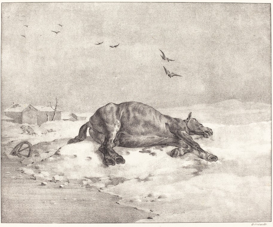
May 21 – A 5-month virtual road trip along the California Trail
204th Road follows the approximate route of the Trail for about 2.5 miles from where it crosses Clear Creek in Nemeha County, Kansas (GPS coordinates -96.193, 39.939). We often think of the hardships along the Trail, which were many. However, we sometimes forget that, though the Trail is said to begin in the “Jumping Off Towns”, travelers along the Trail had many points of origin from which they had to begin their journey prior to arriving at the Missouri River crossings. These hardships were not only felt by the people, but by their animals as well, which were unaccustomed to the grueling schedule of daily travel.
Andrew Hall Gilmore (https://www.octa-journals.org/merrill-mattes-collection/overland-journey-to-california-andrew-hall-gilmore-1850) began his journey near Terre Haute, Indiana. Having already traveled 400 miles to St. Joseph, his party consisted of six wagons, fifty-two oxen, six horses, and twenty-three men. Now, eighty miles from St. Joseph, Gilmore wrote on May 17, 1850 – “A cool wind from the North, cool enough for overcoats. Started at eight o’clock; after traveling a few miles the face of the country became almost level except occasional swells that occurred beautiful on the surface at regular intervals, like spreading meadows; the soil very good, on some parts coarse gravel; the roads fine but quite dusty. Passed today the carcasses of six dead horses, making in all 17 horses and mules since leaving St. Jo., that have sunk under the fatigue of the journey. Encamped for night in the wide prairie by a pool of muddy water which was unfit for everything else but our cattle; but tolerable good water and wood was obtained by carrying them 3/4 miles. Travelled 18 miles.” The 1823 drawing by French artist Theodore Gericault was downloaded from https://www.artsy.net/artwork/theodore-gericault-dead-horse.