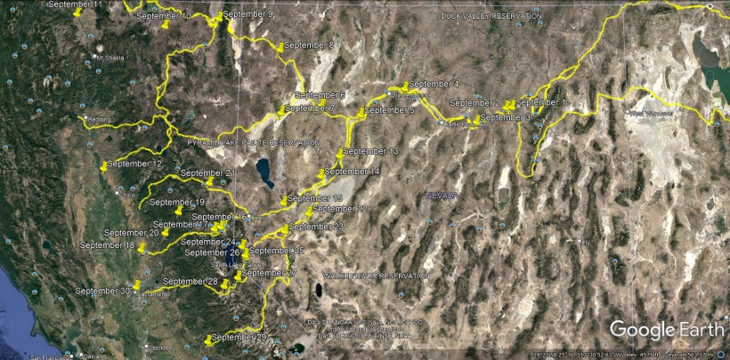
September 15 – A 5-month virtual road trip along the California Trail
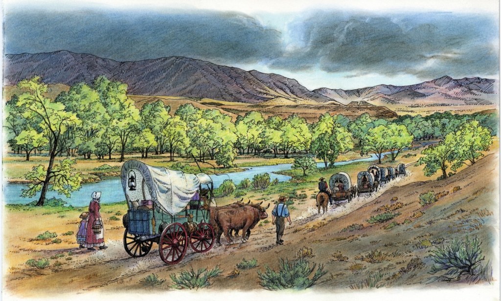
The first wagon route established over the Sierra Nevadas followed the Truckee River. After crossing the 40-mile desert, emigrants were thrilled to have reached water and shade trees. There is a wayside interpretive exhibit located in the westbound I-80 rest area just west of Wadsworth, NV (GPS coordinates -119.336, 39.603) and the accompanying illustration is from that exhibit. Trails West produces a good driving guide to the Trail (available at https://emigranttrailswest.org/trail-guides-for-purchase/truckee-trail-driving-guide/) and you can also find information about the T-Rail markers along the trail on the California Trail Center app at https://ctic.oncell.com/en/truckee-river-to-donner-lake-263617.html.
John Markle (https://www.octa-journals.org/merrill-mattes-collection/diary-of-john-markle-1849-letter-to-the-donner-trail-marking-expedition-from-wendell-robie-1940) described his reaching Truckee River after crossing the desert on August 12, 1849: “About 4 o’clock, Graves and I started ahead of the teams for the Salmon Trout [Truckee] River on foot, with a canteen of coffee and one of hot water and some biscuit. The road was beautiful for 12 miles during which time we passed a salt spring, but the water could not be used. We then ascended a little hill which was steep and very sandy and continued so for 10 miles which brought us to the river, where we arrived between 11 and 12 o’clock in the night. The water was clear and cool. Before we drank any, we filled our canteens and before we were satisfied we drank five pints apiece. We then got in among the willows and slept the balance of the night as comfortably as if we were on a bed of feathers. Three of the wagons got to the river about an hour after sunrise and the other three were left in the sand as their mules gave out. They brought the mules on to the river and watered them and turned them out to graze with the intention of going back for their wagons in the evening.”
September 16 – A 5-month virtual road trip along the California Trail
Donner Memorial State Park (https://www.parks.ca.gov/?page_id=503 GPS coordinates -120.227, 39.322) is the site of the 1846/47 winter lodging of the ill-fated Donner party. The accompanying photograph is from their website. You can visit the interpretive center there and hike the trails through the forest and around the lake. The Donner’s were following the Truckee route and were trapped by an October snowstorm that led to a deadly winter for them.
Patrick Breen’s diary (https://www.google.com/books/edition/Diary_of_Patrick_Breen/Aq9LAQAAIAAJ?hl=en&gbpv=0), a member of the Donner Party, begins with this entry from November 20, 1846: “Came to this place on the 31st of last month that it snowed we went on to the pass the snow so deep we were unable to find the road, when within 3 miles of the summit then turned back to this shanty on the Lake, Stanton came one day after we arriveed here we again took our teams & waggons & made another unsuccessful attempt to cross in company with Stanton we returned to the shanty it continueing to snow all the time we were here we now have killed most part of our cattle having to stay here untill next spring & live on poor beef without bread or salt it snowed during the space of eight days with little intermission, after our arrival here, the remainder of time up to this day was clear & pleasant frezeing at night the snow nearly gone from the valleys.” The remainder of the diary tells the tale of their survival efforts.

September 17 – A 5-month virtual road trip along the California Trail
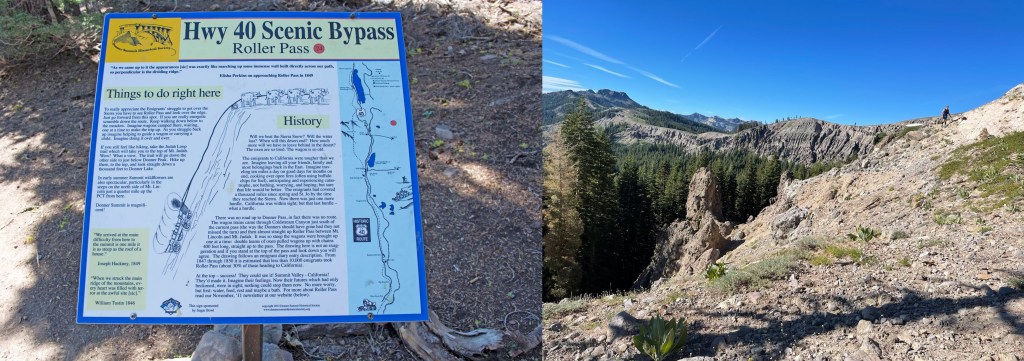
The following two websites provide photos and descriptions of the trail to Roller Pass (https://www.nps.gov/articles/000/a-hike-to-roller-pass-on-the-california-trail.htm and http://the-great-silence.blogspot.com/2020/12/the-historic-roller-pass-hike.html), including the accompanying photograph of an interpretive sign visible along the trail from Highway 40. Roller Pass (GPS coordinates -120.32, 39.295) got its name from the use of logs as “bearings” for ropes and chains stretched over the summit to help stock to pull wagons up the steep grade leading to the pass.
Nicholas Carriger (diary preview in Dale Morgan’s book p. 158 at https://www.google.com/books/edition/Overland_in_1846/zmFHNDDTu7gC?hl=en&gbpv=1&printsec=frontcover) crossed the pass on September 22, 1846: “we made a roller and fasened chans to gether and pulled the wagons up with 12 yoke oxen on the top and the same at the bottom.”
September 18 – A 5-month virtual road trip along the California Trail
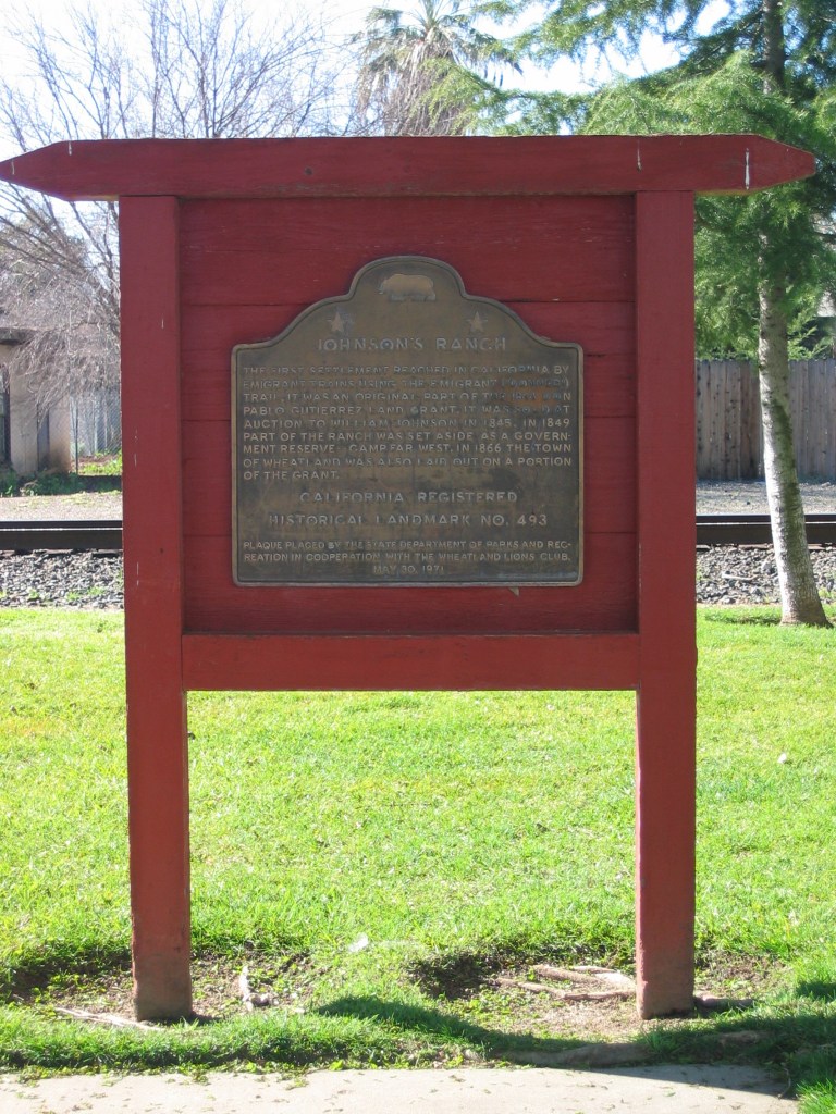
The Truckee River route ended at Johnson’s Ranch (GPS coordinates -121.423, 39.010). The ranch was part of the 1844 Don Pablo Gutierrez Land Grant and William Johnson was able to purchase it in 1845. The Wikipedia article at https://en.wikipedia.org/wiki/Rancho_Johnson is not bad. There is a historic marker about the ranch in Wheatland, CA and described on the Historical Marker Database at https://www.hmdb.org/m.asp?m=10528, from which the accompanying photograph was taken.
In his memoirs regarding his 1846 journey to California, Jacob Wright Harlan (https://www.loc.gov/item/rc01000792/) wrote, “For the last three days we had only a little flour and water. When we arrived at Johnson’s rancho, forty miles from Sutter’s Fort, and heard the cocks crowing, and saw the pastures covered with fat cattle and horses, and with the view of the grand Sacramento valley spread out before us, I was reminded of my dream, which I have described, and of my grandmother’s having foretold on her death-bed that I should be cured of my consumption 50 and be a well man. I traded my mule to Johnson for a pinto horse, and got from him some dried beef, but we found the latter to be so spoiled that notwithstanding our hunger we could not stomach it, and we threw it away.”
September 19 – A 5-month virtual road trip along the California Trail
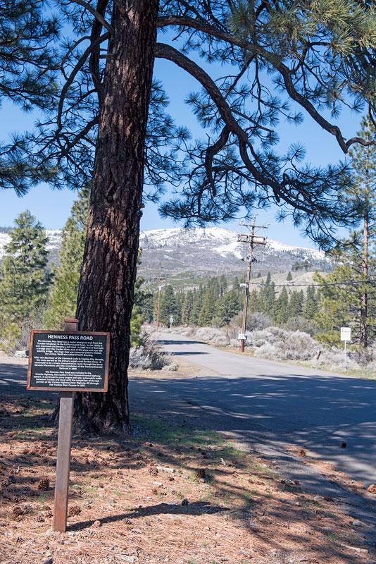
The Henness Pass Road diverged off of the Truckee route near present-day Stampede Reservoir to provide a way to the California Gold Fields in Grass Valley, and also as a route and supply line back to Nevada when the Comstock Lode was discovered. There is a historical marker and Trails West Marker at GPS coordinates -120.874, 39.471 and a description of several markers on the Historical Marker Database at https://www.hmdb.org/m.asp?m=143469, https://www.hmdb.org/m.asp?m=99646, and https://www.hmdb.org/m.asp?m=94297. The accompanying photograph came from this last site.
The road passed through Downieville, as Winslow Blake recorded on August 25, 1852: “Went to Downieville, called one of the smartest mining towns in the country, containing some 4, or 5,000 inhabitants, buildings in the business part of town are very well built a great deal of business is done.” A portion of Winslow’s handwritten diary and letters are available from the OCTA website at https://www.octa-journals.org/merrill-mattes-collection/diary-of-winslow-blake.
September 20 – A 5-month virtual road trip along the California Trail
The Henness Pass and Nevada City roads led to Grass Valley. According to the Grass Valley Chamber of Commerce website (https://www.grassvalleychamber.com/community/history/), Grass Valley was the largest gold producing region in California. You may also find the Empire Mine State Historical Park (https://www.parks.ca.gov/?page_id=499) an interesting place to visit in this region. You’ll also find a historical marker (GPS coordinates -121.060, 39.218), described on the Historical Marker Database (https://www.hmdb.org/m.asp?m=45126) and seen in the accompanying photo from that page, commemorating the Grass Valley Chinatown which it states was “second only to San Francisco’s.”
Helen Carpenter (https://www.octa-journals.org/merrill-mattes-collection/a-trip-across-the-plains-in-an-ox-wagon-helen-carpenter-1857) ended her journey to California in Grass Valley. On October 7, 1857 she wrote, “Three miles from the last bridge we came to Sockumville on Brush Creek. This is the mine that George is interested in and our destination. A little way back from the bank of the creek, and in among some big pine trees, are a lot of miners cabins, they are all one room domiciles of boards with battened cracks, and stick chimneys. They face the road, the diggins and the hill side beyond and in each is a miner who not only puts in regular hours in the mines but does his own cooking and washing. One of the miners lived in a little white house up on the hill side, and his wife in a most friendly way came and invited Penny and me to ‘take tea’ with her, and she would not take no for an answer, so we went although we were not ‘hankering for tea’ – Corn beef and cabbage would have appealed to us. It did not matter for mother had beefsteak, potatoes, etc. etc. for us when we returned. (Oct. 8) – Went to John Swarts little ranch in the suberbs of Grass Valley, and in a few days were permanently located there.”

September 21 – A 5-month virtual road trip along the California Trail
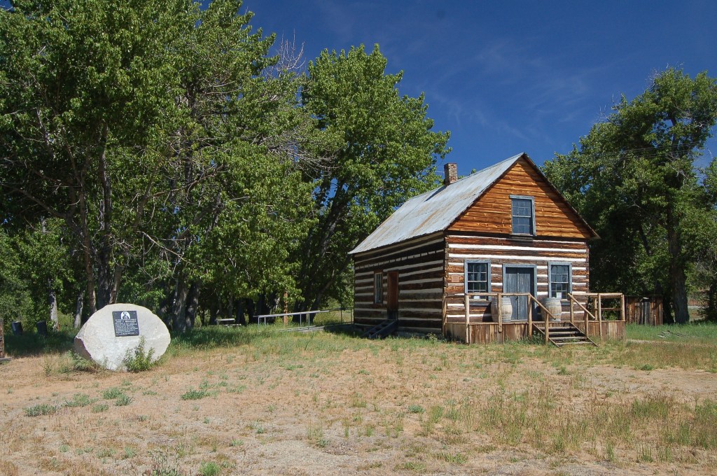
The Beckwourth Trail was another route into California. It left the Truckee River in Truckee Meadows (now where Reno, NV is) and traveled northwest through the mountains until it reached Marysville, CA. The road was built by and named for Jim Beckwourth (https://www.beckwourth.org/Biography/index.html), a well-known African-American explorer. Trails West publishes a driving guide to the Beckwourth Trail (https://emigranttrailswest.org/trail-guides-for-purchase/beckwourth-trail/) and one of his cabins serves as a museum in Portola, CA, (https://www.cityofportola.com/community/pages/jim-beckwourth-museum GPS coordinates -120.422, 39.824). The accompanying photograph is from the Historical Marker Database at https://www.hmdb.org/m.asp?m=56409.
Jim Beckwourth (https://www.google.com/books/edition/The_Life_and_Adventures_of_James_P_Beckw/ziwUAAAAYAAJ?hl=en&gbpv=1&printsec=frontcover) did not keep a journal but dictated his autobiography to T.D. Bonner, which was published in 1856. He relates his discovery and opening of the Beckwourth Trail in Chapter 36: “While on this excursion I discovered what is now known as ‘Beckwourth’s Pass’ in the Sierra Nevada. From some of the elevations over which we passed I remarked a place far away to the southward that seemed lower than any other…. We struck across this beautiful valley to the water of the Yuba…. This, I at once saw, would afford the best wagon-road into the American Valley approaching from the eastward.” He goes on to relate that he got the promise of financial support from the mayor of Marysville only to find the town burning to the ground when he arrived after guiding the first wagon train there. The town could no longer afford to pay him because of the reconstruction costs!