
June 8 – A 5-month virtual road trip along the California Trail
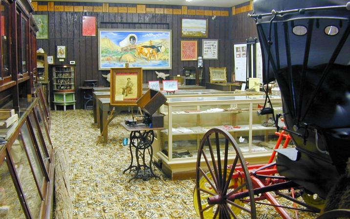
Travelers on the south side of the South Platte river who did not cross earlier would cross near the present-day towns of Julesberg and Ovid, Colorado. You can visit a small museum in Julesberg that tells the story of Fort Sedgwick and the South Platte Crossing here (https://www.colorado.com/history-museums/fort-sedgwick-museum-and-depot-museum GPS coordinates -102.262, 40.987). The photograph is from this website.
James F. Meline (https://www.octa-journals.org/merrill-mattes-collection/two-thousand-miles-on-horseback-by-james-f-meline) wrote in a letter dated June 18, 1866: “Julesburg has six houses, including a store, adobe-yard, blacksmith shop and billiard saloon! This last institution has been established but a short time, and at its advent, ‘All the world wondered;’ – that is, all the world in Julesburg. At Fort Sedgwick, this grand territorial highway branches. Wagons, emigrants, and trains for Montana, Wyoming, Idaho, Oregon, and some portions of Utah and California, cross the South Fork of the Platte and go by the Lodge Pole Creek and Fort Laramie routes [which is about 6 miles west of Julesburg]. The South Fork is fordable here, and a ferry-boat is now nearly completed, to be used at high water. Fort Sedgwick is the most important of the military posts on this route. As already stated in a previous letter, these forts are mere posts or garrisons, having no defensive works whatever. Sedgwick was established in 1864, and is now a four-company post, garrisoned by two companies of the 5th United States Volunteers, one company of the 18th Regulars, and one company of the 2d United States Cavalry; all under the command of Captain Neill, of the 18th Regulars. It is the best-ordered and disciplined fort we have seen since leaving Leavenworth.”
June 9 – A 5-month virtual road trip along the California Trail
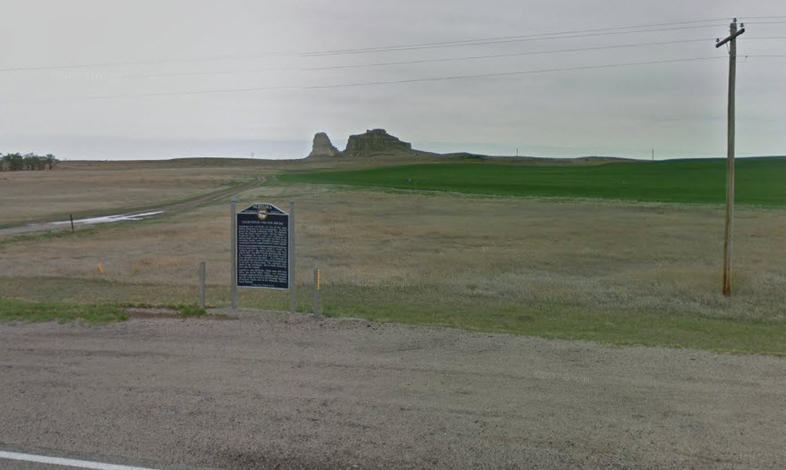
Courthouse and Jail Rocks (https://www.nps.gov/places/000/courthouse-and-jail-rocks.htm) were significant landmarks on the Trail (GPS coordinates -103.115, 41.597). They mark the beginning of a number of erosional remnants that began to break up the horizon of the emigrants’ view. Dr. William Thomas (https://www.octa-journals.org/merrill-mattes-collection/diary-of-dr-william-thomas-1849) wrote on May 29, 1849, “This afternoon about 2 o’clock, I discovered
there was something a little to the right of the road which attracted universal attention I hastened up to discover if
possible what the great curiosity could be, when low and behold there, gushing from beneath a slight elevation was a stream of as clear, as pure, as cold, water as I ever saw. I had been walking for several miles and the evening was warm and pleasant, consequently it was to me the greatest treat that could possibly have been found- I took a hearty pull again and again, was loathe to leave it, but the waggons were leaving me, and I was forced to leave the greatest prize that I had seen since I left the States Soon after leaving the spring, we came in sight of the Courthouse or Church Rock – This is a rock of immense size presenting from the road the appearance of an immense house, some three hundred feet high by one hundred square. At about one hundred feet above its base there is an offset in the wall, as though it had been drawn in to make it smaller – Some halfway from that to its summit there is yet another effect giving it a grand and imposing appearance much resembling a church or courthouse- hence its name – I had not an opportunity of visiting it but was informed by one of our company who examined it that it was situated on a sandy plane he did not discover the smallest stone within two or three miles. It appears to be a composition or cement of gravel & dirt. We encamped about 7 miles from it though it appeared to be not more than one and 1/2 miles, owing perhaps to the blueness and purity of the atmosphere”. The photo is from Google Maps Streetview at https://www.google.com/maps/@41.6005163,-103.0987878,3a,75y,264.49h,81.41t/data=!3m6!1e1!3m4!1si988ZXFsbQTIpQP-f0QeVQ!2e0!7i13312!8i6656.
June 10 – A 5-month virtual road trip along the California Trail
Chimney Rock is another frequently mentioned curiosity in emigrant diaries. The photos are from Google Maps Streetview at https://www.google.com/maps/place/Chimney+Rock+Historical+Marker/@41.7204113,-103.339023,173m/data=!3m1!1e3!4m5!3m4!1s0x877008925619a8fb:0x188e1095b096c03a!8m2!3d41.7204113!4d-103.3385494. The historical marker in the photo is located at GPS coordinates -103.339, 41.720. You can find out more about visiting Chimney Rock at https://www.nps.gov/scbl/learn/historyculture/chimney-rock.htm. Phoebe Judson, in her book A Pioneer’s Search for an Ideal Home (https://www.sos.wa.gov/library/publications_detail.aspx?p=21) about her journey on the Oregon Trail in 1853 wrote, “The next noted land mark to which we came was Chimney Rock, the tall chimney having been in view, and seemingly quite near, for several days, the peculiarity of the atmosphere causing distances to be quite deceptive. We camped within two miles of it, giving a number of our party the pleasure of paying a moonlight visit to this curious freak of nature, with its chimney-like shaft rising to a height of one hundred feet. These land marks indicated our progress and helped to break the monotony like the mile stones along the journey of life, there was one less to pass.”

June 11 – A 5-month virtual road trip along the California Trail
Scotts Bluff National Monument (https://www.nps.gov/scbl/index.htm GPS coordinates -103.707, 41.829) is a must-visit site along this virtual journey. Not only will you see Scotts Bluff, but you can also view portions of the William Henry Jackson paintings and photographs collection (https://www.nps.gov/museum/exhibits/whj/index.html) in the visitor center there. The photograph was downloaded from the NPS website.
The first recorded story of the origin of the name for Scotts Bluff comes from Chapter 6 of the 1830-1835 journal of trapper Warren Angus Ferris (https://user.xmission.com/~drudy/mtman/html/ferris/index.html). “We encamped on the twenty‑seventh opposite to “Scott’s Bluffs,” so called in respect to the memory of a young man who was left here alone to die a few years previous. He was a clerk in a company returning from the mountains, the leader of which found it necessary to leave him behind at a place some distance above this point, in consequence of a severe illness which rendered him unable to ride. He was consequently placed in a bullhide boat, in charge of two men, who had orders to convey him by water down to these bluffs, where the leader of the party promised to await their coming. After a weary and hazardous voyage, they reached the appointed rendezvous, and found to their surprise and bitter disappointment, that the company had continued on down the river without stopping for them to overtake and join it…. The reason given by the leader of the company for not fulfilling his promise, was that his men were starving, no game could be found, and he was compelled to proceed in quest of buffalo. Poor Scott! We will not attempt to picture what his thoughts must have been after this cruel abandonment, nor harrow up the feelings of the reader, by a recital of what agonies he must have suffered before death put an end to his misery. The bones of a human being were found the spring following, on the opposite side of the river, which were supposed to be the remains of Scott. It was conjectured that in the energy of a dying despair, he had found strength to carry him across the stream, and then had staggered about the prairie, till God in pity took him to himself. Such are among the sad chances to which the life of the Rocky Mountain adventurer is exposed.”
June 12 – A 5-month virtual road trip along the California Trail
Just across the North Platte river is the gravesite of Rebecca Winters (https://www.nps.gov/places/winters-grave.htm GPS coordinates -103.617, 41.843), who died of cholera in 1852 while traveling on the Mormon Trail (https://www.nps.gov/people/rebecca-winters.htm). The photograph is from the Historical Marker Database (https://www.hmdb.org/m.asp?m=86666).
John Hawkins Clark (https://babel.hathitrust.org/cgi/pt?id=uc1.31822035077213&view=1up&seq=28&skin=2021) was traveling on the south side of the North Platte river during 1852 and he commented several times on the cholera epidemic plaguing the travelers. On June 4, after having just visited Ash Hollow (see the June 7 Facebook page post), he wrote, “Just before leaving the valley we visited a graveyard pleasantly situated on a rising mound- There were four newly made graves and three of older date, the occupants of which were, perhaps, strangers, coming from different parts of the world to lie down and sleep together in this quiet place. Although a most beautiful valley death had been busy; only a few days ago four of the occupants of this quiet little graveyard heard the birds sing and saw the beautiful flowers growing. Sickness and death have marred the pleasures of our journey thus far, but how long it will continue to do so Providence only knows. Wherever there is a little shady grove where we might stop and view the beautiful scenery as it presents itself in many places, our spirits are dampened by the sight of fresh earth piled up in an unmistakable form, showing that beneath it lies the inanimate form of some being who, like ourselves, delighted in viewing nature in such beautiful forms as it everywhere presents itself in the neighborhood of our travels.”

June 13 – A 5-month virtual road trip along the California Trail
Robidoux Pass and Trading Post were on an alternate route that passed south of Scotts Bluff. The photo is from Google Maps Streetview along Robidoux Road. The marker photograph and location were downloaded from the Historical Marker Database at https://www.hmdb.org/m.asp?m=99134 (GPS coordinates -103.827,41.803). James Bennett described the trading post on June 22, 1850: “Today at nine o’clock a.m. we arrived at Scott’s Bluffs. The road leaves the river at this point by a circuitous route for thirty miles. We met an Indian trader here with a two horse wagon, who pointed out to us an excellent spring, seven or eight miles ahead. He also stated that there was a regularly established trading post three miles to our left, where we could see a herd of cattle grazing. Having reached the spring in the afternoon, we found here an encampment of near a hundred Sioux Indians. The village contained thirteen lodges and a row of rudely constructed huts. Removed from these, perhaps three hundred yards, were two Frenchmen with their Indian wife and children. They were having a dog feast. Near their campfire was the head of a large mastiff; a bleeding evidence of the fact. We procured a good supply of wood and clear and cool water here and encamped three miles further in the bluffs.” There is also a pioneer cemetery two-tenths of a mile further west along the road from the Robidoux Pass marker.

June 14 – A 5-month virtual road trip along the California Trail
Fort Laramie National Historic Site (https://www.nps.gov/fola/index.htm GPS coordinates -104.558, 42.203) is a fort that operated in various forms from 1834 to 1890. It was a significant way-station for emigrants at which they could re-supply and obtain repairs or medical attention. It was also the gateway to more mountainous country where roads and water access were becoming more difficult. The photograph is from Google Maps Streetview at https://www.google.com/maps/place/Fort+Laramie+National+Historic+Site/@42.2029097,-104.5533177,2973m/data=!3m1!1e3!4m5!3m4!1s0x8765b3828e45a49f:0x1e4ee4bf0a23a45b!8m2!3d42.2029097!4d-104.5465669.
In his reminiscences of his journey to California in 1852, Joseph C. Terrell (https://www.octa-journals.org/merrill-mattes-collection/joseph-c-terrell) wrote, “Here we are at Fort Laramie, a strong military position, situated at the junction and between the North and South Platte Rivers, the latter now mapped as Lawrence River, occupied by a strong garrison which raises its own corn and vegetables…. The oxen and horses must be shod – cows even worse than the oxen, pull against each other in the yoke, which wears off the outside of their hoofs. Changing them in the yoke does little good. They charge here at the Government post private enterprise with a pull – sixteen dollars for shoeing oxen by the yoke, and fifty cents per dozen for nails. Having two good blacksmiths in our company, we paid twenty-five dollars for the use of the shop for one night. Our men made shoes, etc., from iron obtained from broken down vehicles. They made sixty-four shoes, with more nails than enough, and worked all night, thus saving $20.75. We surely thanked Mr. Campbell and Mr. Forman. Strange, I am too feeble to walk, yet feel that I am perfectly well. They falsely accuse me of taking a whole box of Tutt’s pills, because the box was missing. Are traveling up north side of North Platte; hilly, dusty and very deep sand; beautiful roses in sight, and general health of the voyagers good. Left the river; lots of blacktail deer.”

