Yes, even though I work here now, I wanted to do a blog post about the California Trail Interpretive Center. Darlene and I went and visited it as tourists before my first day working there, and, of course, I’ve learned quite a bit about the place since starting work. This is a truly cool place to visit! I apologize for the length of this blog. Come visit. There’s a TON of stuff to learn!
The Entrance Plaza
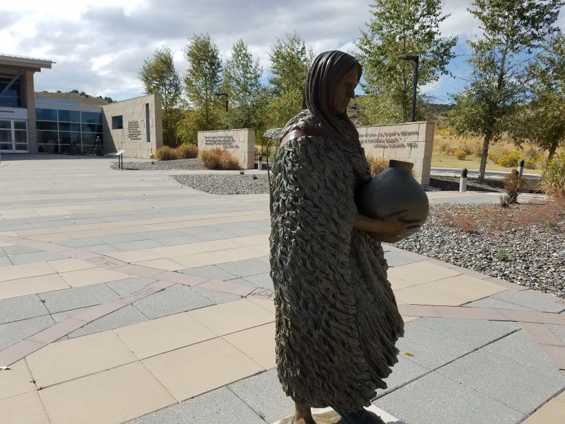
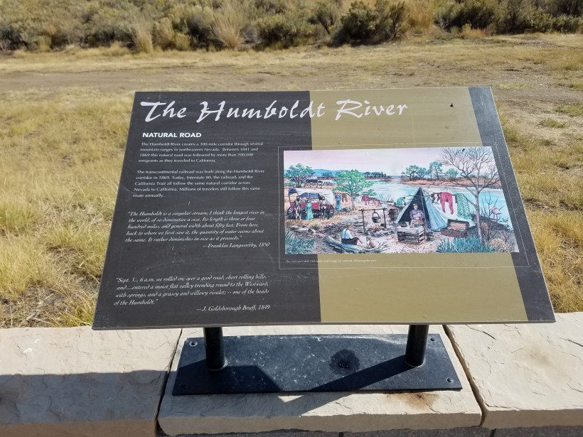
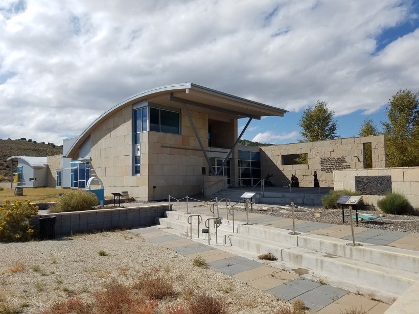
When you first arrive at the plaza in front of the center you’re greeted by this Shoshone native woman. All the bronze figures were sculpted by Dianne Cooper.You’ll immediately notice embedded among the pavers in the plaza that there is a to-scale map of the various segments of the western portion of the California Trail.As you enter the plaza from the parking lot, the first marked point on the trail map is South Pass, which is in Wyoming. It is shortly after this point that emigrants would decide whether to continue following the Oregon Trail, or branch off and head to California. Notice the light/dark colored bands in the pavers. Each band represents 10 miles, which is about an average day’s journey for the wagon trains.There are informational signs scattered around the plaza which tell you about some of the features, peoples, and decisions facing the emigrants as they traveled.The Humboldt River, represented by this sculpture in the plaza, travels about 300 miles across Nevada. The California Trail followed this river through the territory. Interestingly, the river begins at a set of springs and ends by soaking back into the ground.In addition to the bronze sculptures, there are a number of interesting quotes displayed on the plaza walls.The plaza ends at the entrance to the center. The embedded trail map ends just left of the building, depicting the point where the California Trail enters what is now the state of California. As a visitor, you’ve simulated walking the 600+ miles from South Pass, Wyoming (the parking lot) to the Sierra Nevada Mountains (the Trail Center)!
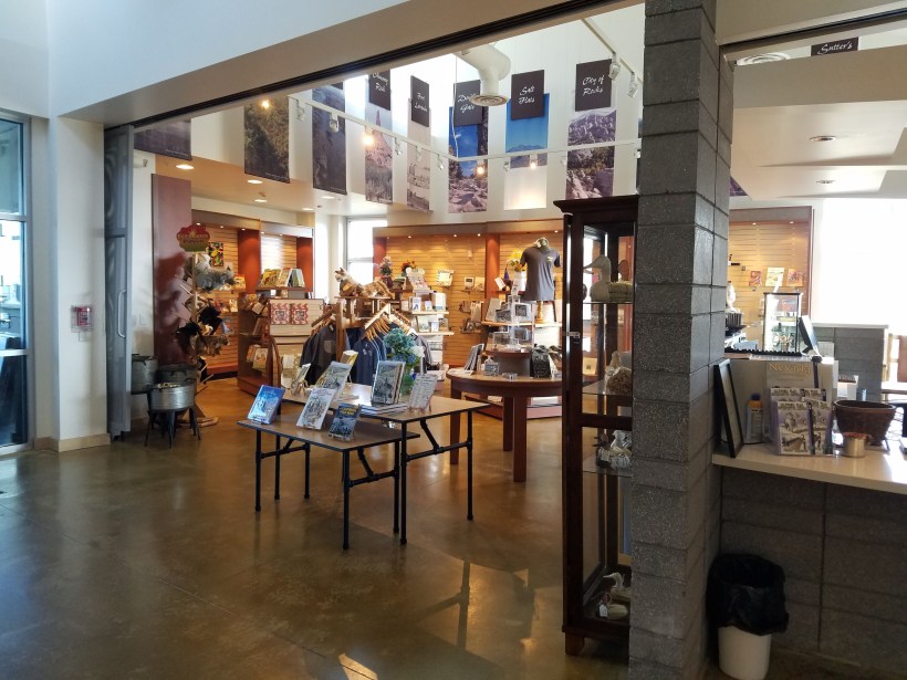
The Lobby
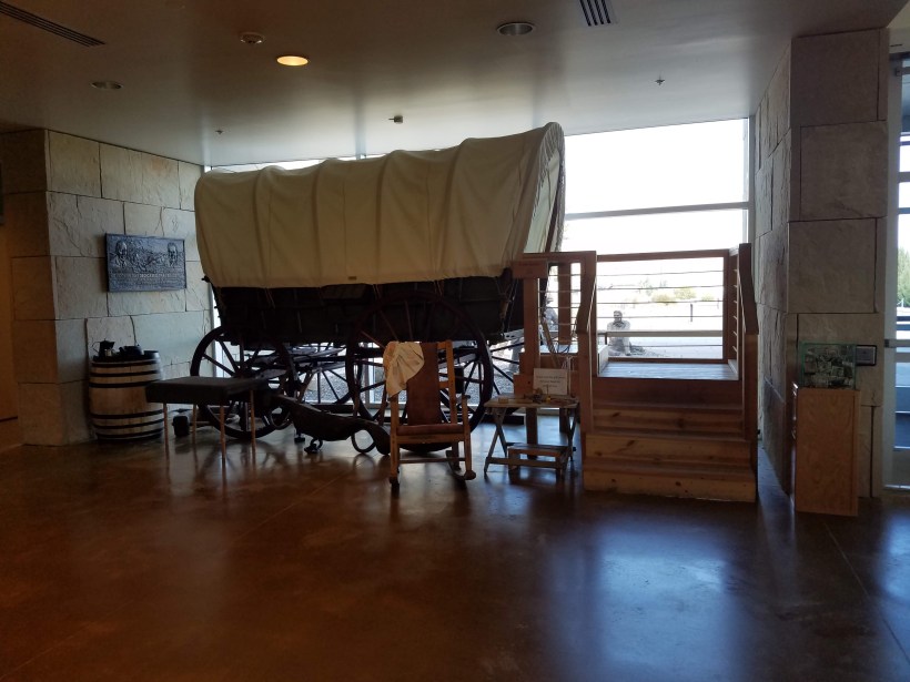
The first thing you see when you enter the building is this large map and mural.
The map depicts the various segments of the 2100+ mile California Trail in white. The other westward expansion trails (e.g. the Oregon Trail, Santa Fe Trail, Mormon Trail, Pony Express) are also shown, along with the names and locations of the various Native American peoples. There is a timeline of major events in American History and a mural above which depicts some of the people and themes contained in the Center’s exhibits.There is a wagon replica in the lobby as well which you can climb in, as well as example personal articles and children’s toys which you can handle.Of course, there is a gift shop and book store with a wide variety of Trail related items available.
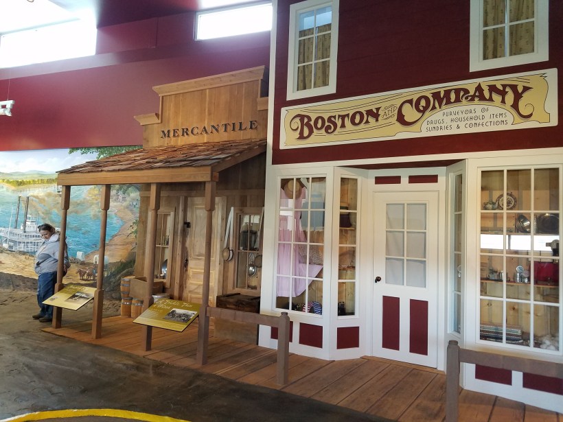
The Kickoff Points in Missouri
In 1841, the western edge of the United States was the Missouri River. The Oregon Trail had already been opened by now, but emigrants began seeking paths to the Mexican territory of California. America had been in recession in the previous decade and adventurers and families alike were seeking new territory and prosperity. As you enter the Trail exhibits, you will begin at one of the “kickoff” points like Independence or Saint Joseph.
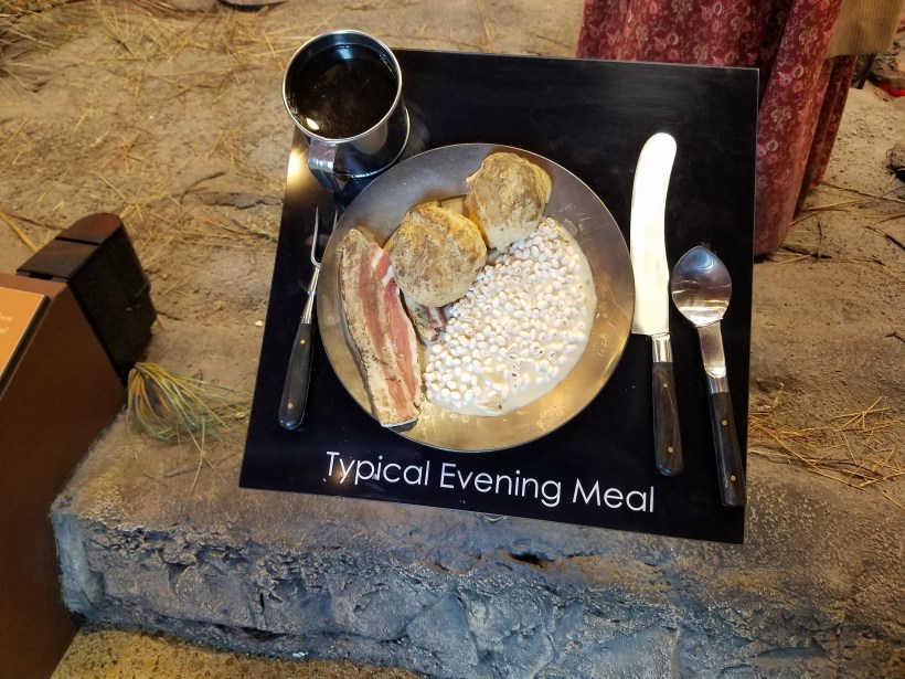
This bronze sculpture of an elephant is an iconic part of the Trail’s interpretation. In a number of diaries and accounts of the trail, people refer to “seeing the elephant”. This was a phrase popular during those times and represented seeing something you’ve heard of but was beyond your ability to comprehend until you actually saw it. Many people said in their journals after traveling the Trail that they had “seen the elephant” at last, now finally understanding all they had heard about the wonders and trials of the journey west.In this room you’ll find an orientation video, and interactive touch screen and more examples of supplies which might be gathered for the 5 to 6 month journey.Do some window shopping in the city’s stores.Prepare to load your wagon on the steamboat to cross the river, or sail upstream a bit before launching your westward trek!Learn about all the various supplies needed for the trip and the animals and equipment needed for support.Try your hand at packing all that stuff into a wagon!
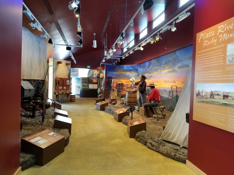
The Platte River Room
As you leave Missouri, you will follow the North Platte River across the Great Plains, encountering various wildlife and natives, and making your way along the same route as the Oregon Trail and the later Mormon Trail and Pony Express routes. You’ll make sure to resupply at various trading posts along the way, including what would become Forts Kearney and Laramie.
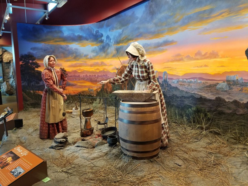
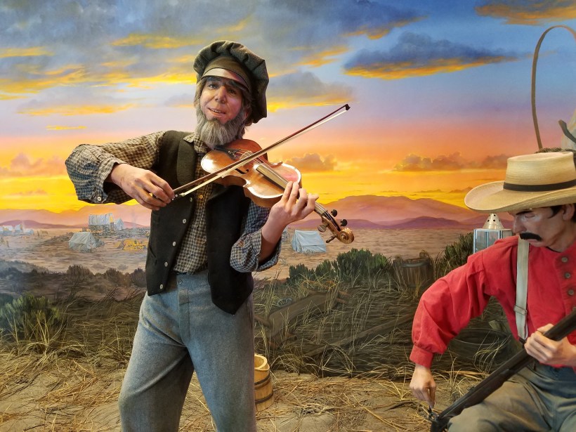
There are two dioramas in this room. The left one depicts trading between and emigrant and a native. The right one depicts a typical campsite.Note the person in the wagon viewing the transaction with trepidation. One of the themes of the Center is the impact that westward expansion had on the native peoples. This scene depicts trading via the use of sign language and encourages you to try it out yourself. You can also think about the clash of cultures that occurred during these times.In the campsite you’ll see how the buffalo (bison) “chips” were a primary source of fuel for fires because of the lack of wood across the prairie.Even after traveling 10 to 20 miles in a day, emigrants found ways to relax and entertain themselves in the evening.
Often the wagons were so full of stuff, they weren’t used as much for sleeping or even riding in.As you can see in the background, there were often many wagons traveling together.
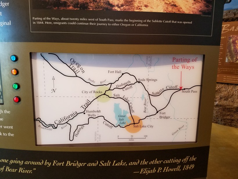
Parting of the Ways / Great Basin
The emigrants crossed the Rocky Mountains at South Pass in Wyoming. In 1841, the Bartleson-Bidwell party is the first wagon train to leave the Oregon Trail and strike out for California. They were the trailblazers, because there was no road or path to guide them. They would follow the occasional path blazed by trapper, natives, or wildlife, but mostly they just sought a means of traveling westward. This party headed south around the Great Salt Lake. Other parties in later years would follow that way, or explored routes north of the Lake. Lots of “cutoffs”, or alternate paths, developed during those early years as people sought easier or faster or safer routes. As you travel through the Interpretive Center you’ll read or hear accounts from this first wagon train. You’ll also read or hear from another, possibly more famous, party – the Donner/Reed party.
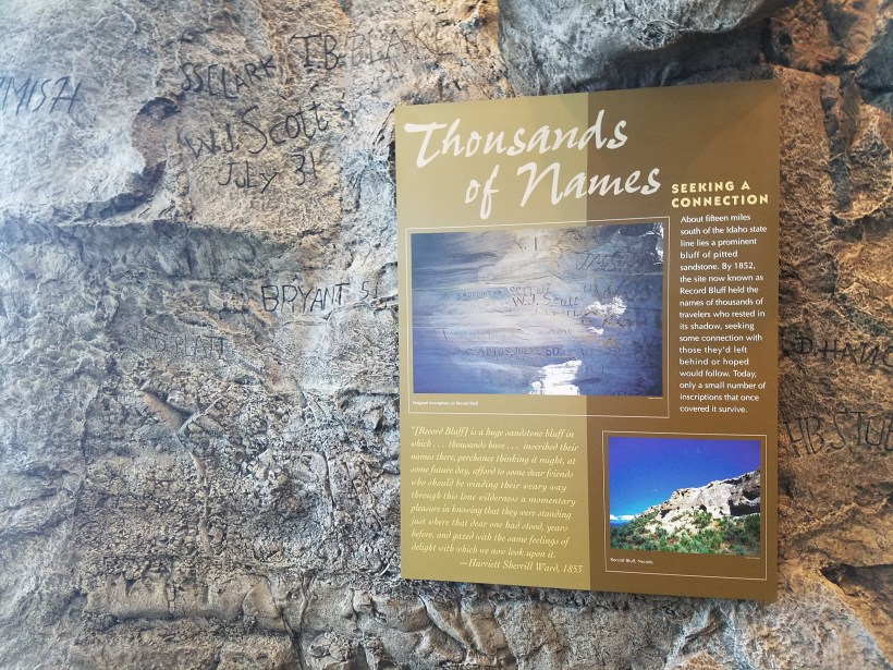
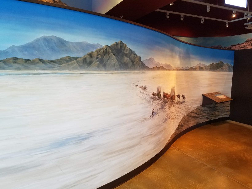
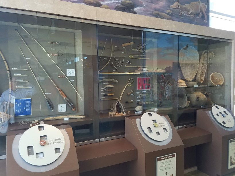
At this point in the Center you also will make a choice about which route to travel. Either north of Salt Lake or south, each route has its pros and cons.As you leave South Pass and enter Devil’s Gate on the northward path, you can try on various pioneer garments if you choose.The “City of Rocks” in what is now southern Idaho was a well chronicled landmark.You’ll see a mockup replica of Record Bluff in extreme northeastern Nevada. This is one of a number of places where emigrants would carve or write their names for travelers coming after them to know that they’ve come this way.If you chose the southern route, you have to cross the great salt flats south and west of Great Salt Lake.As you enter the Humboldt River valley and the Great Basin, you’ll encounter the Shoshone (Newe) people and learn about their lives.You’ll see some of their tools and crafts and learn about Sarah Winnemucca, a Paiute who tried to serve as peacemaker between the encroaching U.S. government and the natives.You’ll explore a bit further the various effects on native culture and life as westward U.S. expansion continued.
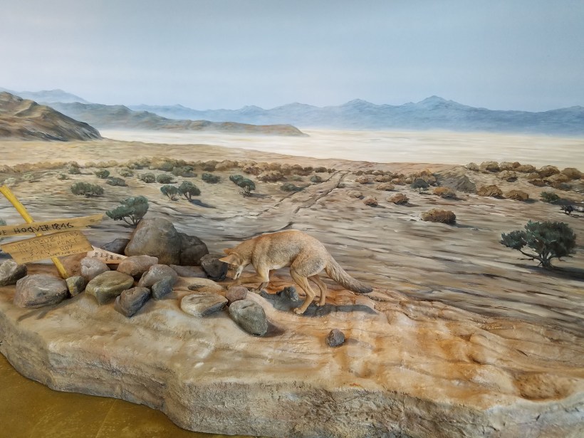
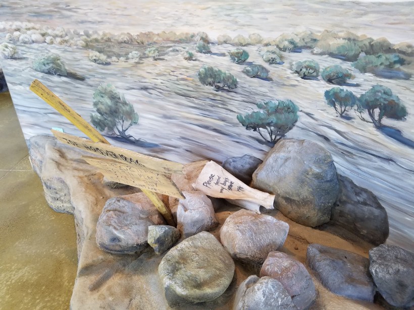
The Forty Mile Desert
One of the most difficult sections of the Trail lay at the eastern feet of the Sierra Nevada Mountain Range – an area referred to as the forty-mile desert. This stretch had not water or grass for the livestock and was the cause of death of many an animal and not too few people who were already weakened to the point of exhaustion.Here you see the facsimile of a grave of a young child lost to the ravages of the elements.The desert was littered with the bones of animals and discarded supplies as people tried to lighten the loads for their animals. The Bidwell-Bartleson party of 1941 had abandoned their wagons back near the Great Salt Lake.
The Sierra Nevadas
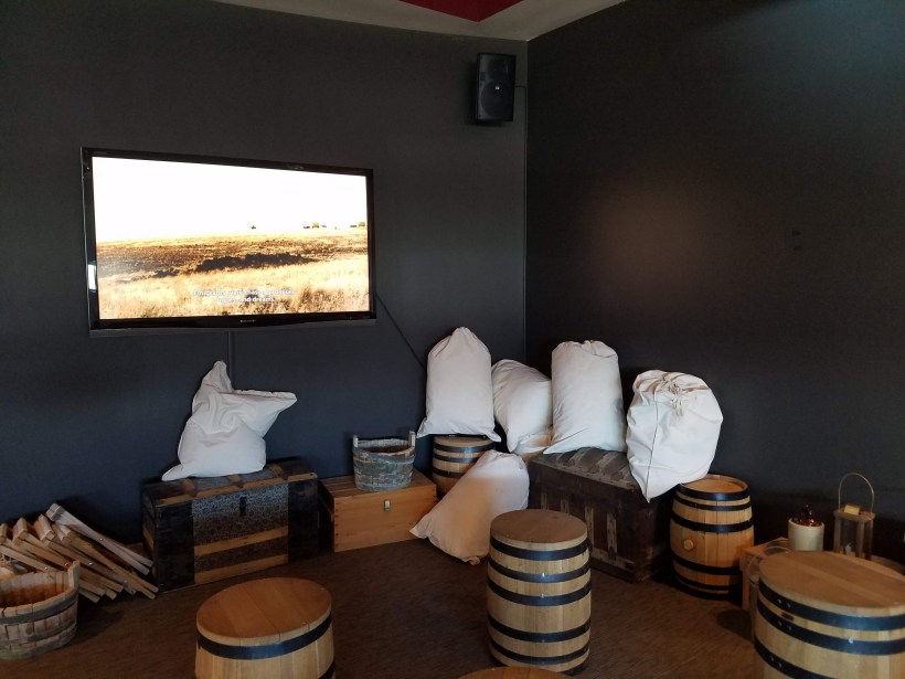
A number of signs depict the last stage of the journey – crossing the nearly insurmountable Sierra Nevada mountains.There were many routes attempted across the mountains in search of ways passable for wagons. Many times, wagons had to be dismantled and hauled piece by piece up cliffs, or tied to multiple logs as ballast to slow them down as they descended the western slopes.The tragedy of the Donner-Reed party is discussed in detail throughout the Center.A number of unfortunate events and decisions led to the misery and horrors experienced by this party. The Center has an 11 and a half minute multimedia presentation about the Donner party.
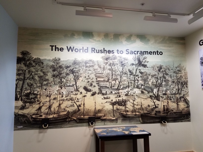
Sutter’s Fort (Sacramento)
The California Trail led to the San Joaquin Valley of California. Over the span from 1841 to 1869 over 250,000 people traveled the Trail. A great majority of these travelers did so as a result of the discovery of Gold at Sutter’s Mill in 1848. Known as the “Forty-niners” these people went to California either to make money from prospecting for gold, or to make money from the miners themselves.
You’ll see how the gold rush attracted people not only across the overland trail, but also by ship around South America or ship/overland combinations across the Isthmus of Panama.You’ll learn about the various ways that miners searched for gold.You’ll also explore some of the different ethnic groups attracted to California by the prospects of gold.Finally, you’ll learn about the impact that the telegraph had (and the demise of the short-lived Pony Express).The Transcontinental railroad was completed in 1869, marking the fundamental end of the California Trail migrations. The Trail lasted for only 28 years, but later became the route used by government roads and rails.There is an interesting photomosaic depicting a wagon crossing the prairie.Closer inspection reveals the mosaic to be a collage of photos taken during the design and construction of the California Trail Interpretive Center.
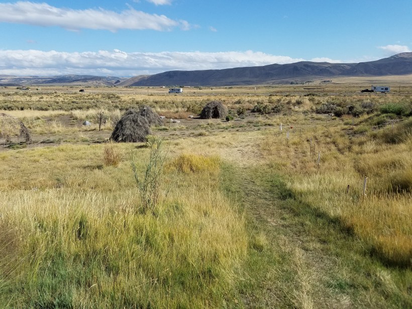
The Shoshone Summer Village and Wagon Camp
Outside the Center, beyond the plaza, is a recreation of Shoshone Summer village.
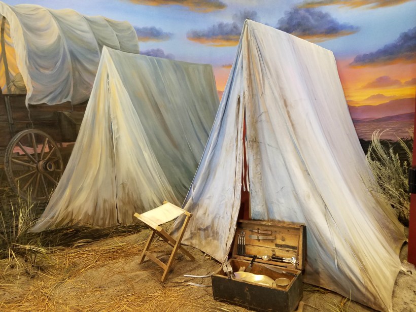
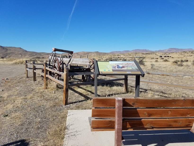
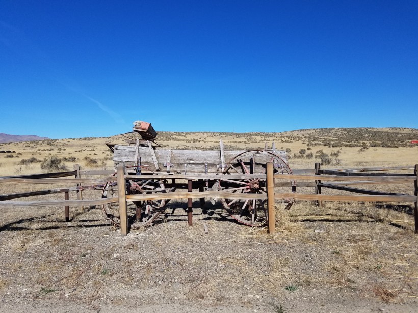
The sage huts were built using the same methods and materials used by the native populations. These villages would be built and used over the course of a summer and then abandoned during the winter. New villages would be built the next year.The wagons shown here are careful reproductions of the “prairie schooners” often used by emigrants. They are arranged for non-winter visitors to depict a camp setup. They are stored under shelter for the winter. There is also an authentic 1850’s wagon on display near the camp as well.
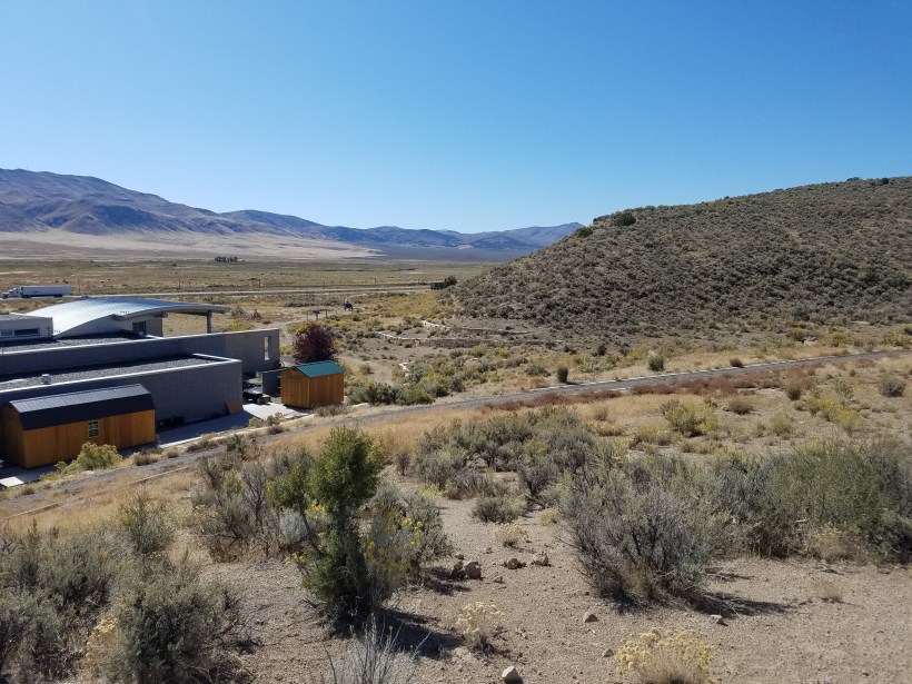
The Outdoor Trails
You’ll also find several short ADA accessible trails on the hillside behind the center.
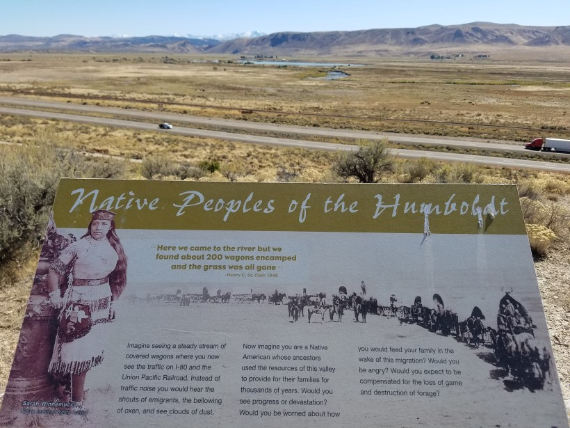
This view to the west looks down the Humboldt River valley.This view southward shows the snow-capped Ruby Mountains in the distance. The route of the Bartleson-Bidwell party and the Donner Party went across or around these mountains and entered the Humboldt River valley through the small canyon in the foreground. This “joining of routes” with the main Trail next to the Humboldt River is the primary reason the Center is located where it is.
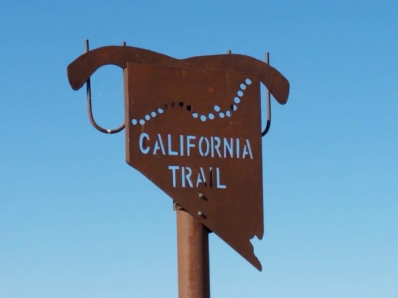
The California Trail
As stated earlier, the Trail stretched from Missouri to California in a myriad set of alternate paths. There are still places where the original wagon ruts and trail depressions (swales) can be seen. I’ve been able to visit a few of them here in the Elko area, as well as some in Wyoming when we lived in Colorado.
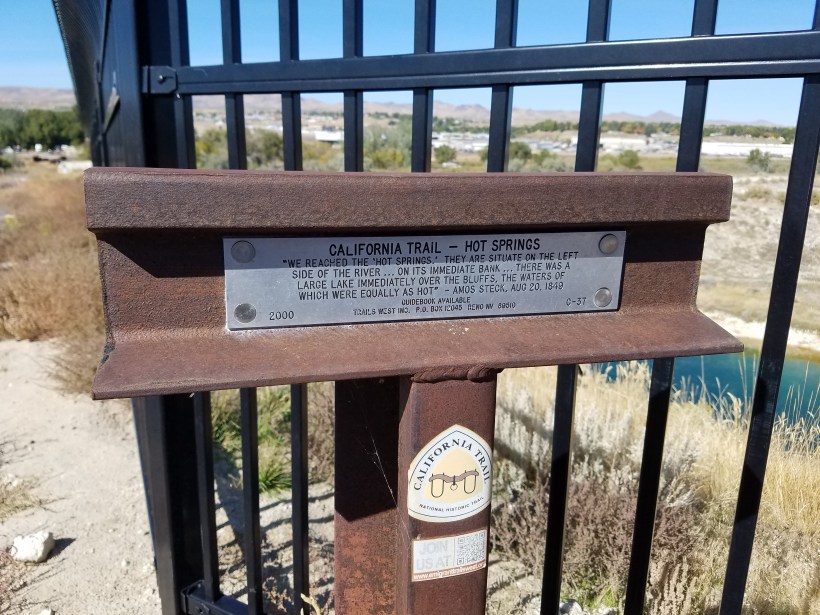
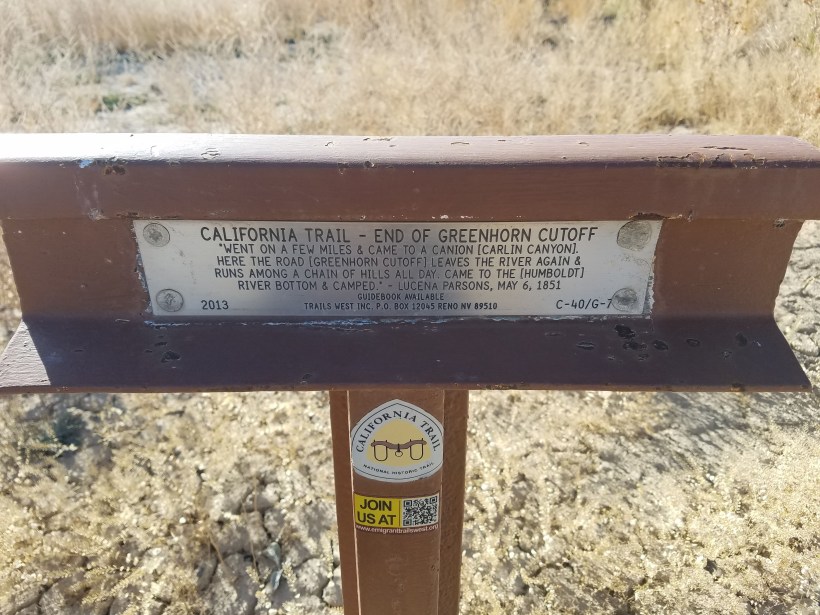
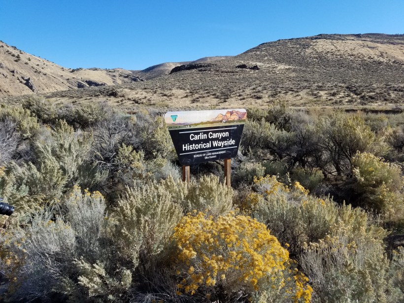
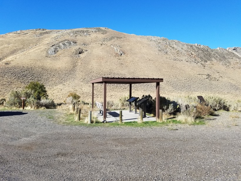
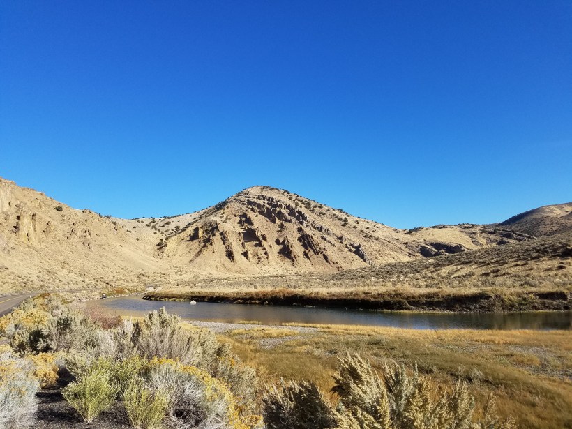
This is the “Hot Hole”, a very hot thermal spring in Elko. It was mentioned in several emigrant diaries. While this pool is too hot for safe use, there is a spring downhill from here that runs down into the Humboldt River and would make a warm bathing area for travelers.A non-profit organization called Trails West places markers like this one at known places along the Trail. Each marker is constructed from welded pieces of railroad track with the horizontal piece sitting parallel to the direction of the Trail at this point. There is also a brass marker which a quote from an emigrant diary about this particular location.This trail marker is in the town of Carlin about 10 miles west of the Trail Center.The Carlin Canyon is just east of this point (see the next set of photos). It was an easy route through the canyon, but travelers worried about getting caught in potential floods sometimes chose a longer router across the top of the ridge. This route became known as the Greenhorn cutoff, referencing the “greenhorns” who were too worried about high water to risk the shorter route.Carlin Canyon is just off I-80 but is only accessible by exiting in Carlin and driving east a few miles. The road through this canyon, now a dead-end, used to be the transcontinental rail bed and Highway 40, or the Lincoln Highway, before I-80 was built, and also served as the bypass while the currently existing I-80 tunnels were constructed.There are two wayside exhibits in Carlin Canyon telling about the Trail through here.You will also learn about other historical folks or events besides things pertaining to the California Trail.
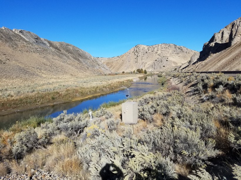
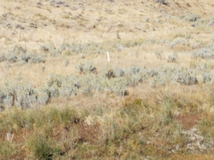
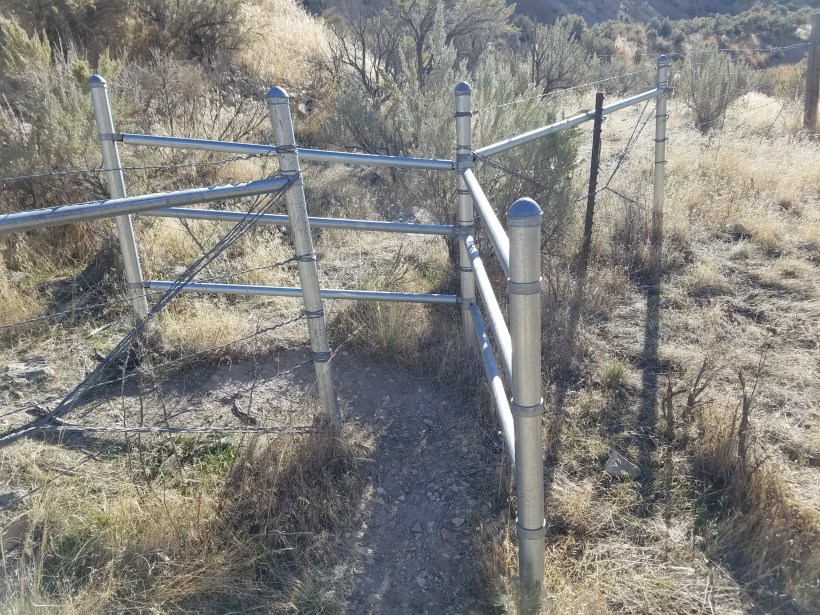
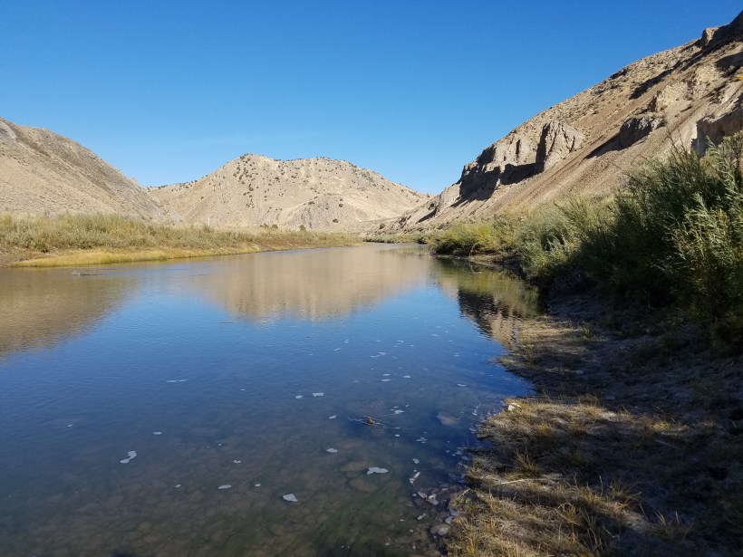
The Trail actually crossed the Humboldt River four times in this small canyon.Places along the Trail that are definite known traces of the trail are often marked with these white plastic (Carsonite) markers.The Bureau of Land Management (BLM) has installed occasional pathways through fencing to allow access to trail seekers.The Humboldt River in Carlin Canyon.For you geology nerds… this is a classic angular unconformity!Another Trail wayside exhibit at the western end of the town of Carlin.This is a cool wagon, but a bit more recent (albeit weathered) than one used on the Trail.
The National Park Service (NPS) has oversight of the whole National Historic Trails system, including the California Trail. If you’re interested, take time to explore that website. You also might be interested in this PDF downloadable List of Known Emigrant Diaries.
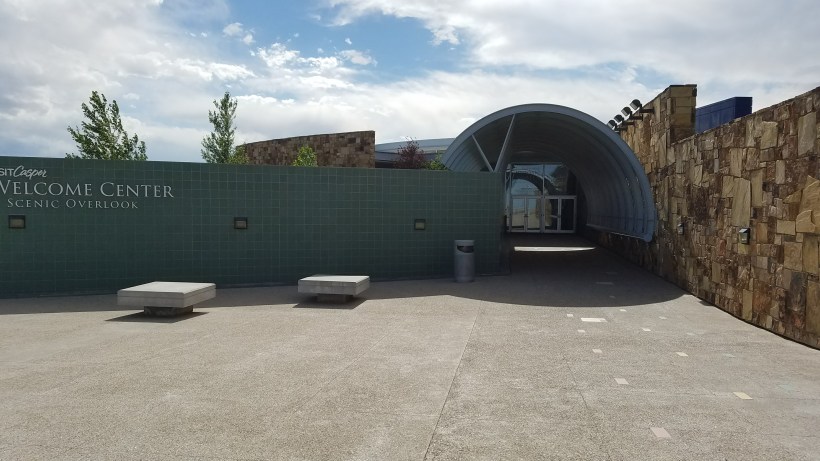
All of the historic trails are operated and interpreted through multi-agency efforts. The BLM actually runs the California Trail Center here in Elko, NV. They also run the Oregon Trail Center in Baker City, OR and the National Historic Trails Interpretive Center in Casper, WY.
I had a chance to make a brief visit at the National Historic Trails Center in Casper on a business trip shortly before I retired from Drillinginfo.
Finally, if you’re read this far and are still interested, watch this 25-min YouTube video about searching for and preserving the historic westward expansion trails.
One thought on “Travel Log: The California Trail Interpretive Center”
Back in 1999 I took a photo of 3 trail signs and am wondering the location. They show the Ccalifornia Trail on top, the Pony Express below (auto tour route) and the Lincoln Higway on a separate sign below. Would you have any idea near what California town this was located?


Back in 1999 I took a photo of 3 trail signs and am wondering the location. They show the Ccalifornia Trail on top, the Pony Express below (auto tour route) and the Lincoln Higway on a separate sign below. Would you have any idea near what California town this was located?
LikeLike