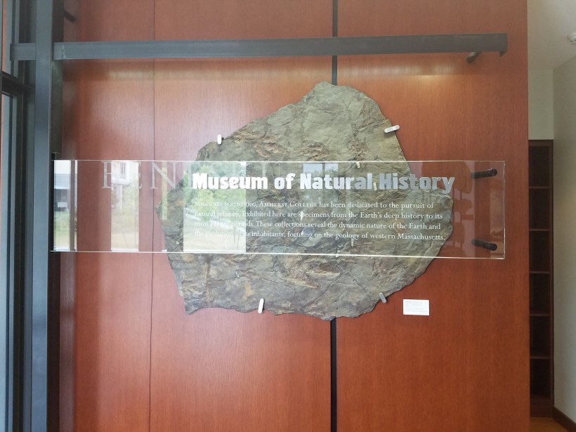
We took the opportunity to drive down to Massachusetts to Amherst (about 90 south of us) to visit the Beneski Museum of Natural History on the campus of Amherst College. I had read a little about the displays they have there and, with my interest in geology, wanted to go see it.
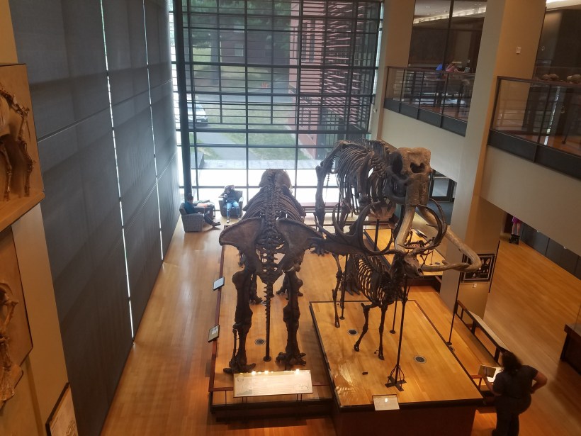
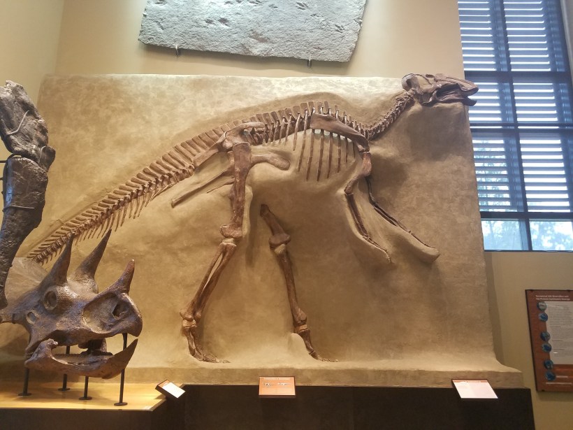
The museum is located in the Beneski building, which also houses the geology classrooms and laboratories for the study of geology at Amherst.It contains three floors of exhibits. The top floor has information about local geologic history, the main floor (shown here) has numerous skeletons displayed, and the bottom floor focuses on dinosaurs and trackways.This diorama is similar to the ones at the Denver Museum of Nature and Science – Prehistoric Journey – in that the geologic evidence for the construction of the diorama is displayed around the room.
Edward Hitchcock was the third president of Amherst college. He is a fascinating man, one whom I quoted (among many others) in my Geology Master’s thesis literature review section. Hitchcock was a preeminent early geologist who was also a Christian. He believed very strongly in the dual revelations of God in nature and in the Bible. Hitchcock studied and wrote about his geologic observations and proposed various ways to harmonize scripture with the increasingly abundant fossil record, age of the earth, and variety of sedimentary structures. His views are not unlike the views still proposed by some in the science/faith debate today, including Reasons to Believe, of which I have been a supporter for many years.
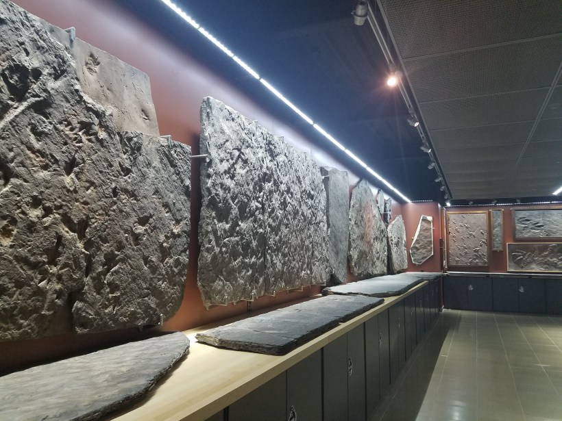
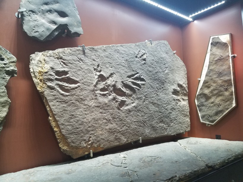
One of the things that Edward Hitchcock was instrumental in was the study of fossil trackways. He was a pioneer in the field of ichthyology and amassed a collection of tracks which are still studied today.Many of the trackways are large slabs of rock which have been excavated and hang vertically on display.
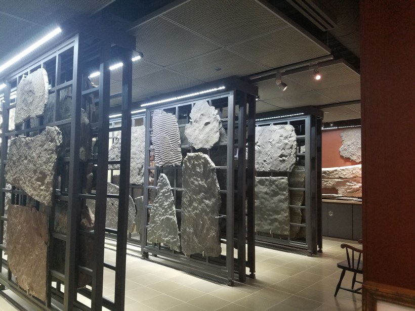
There is also an extensive display of fossils located in drawers along the wall.
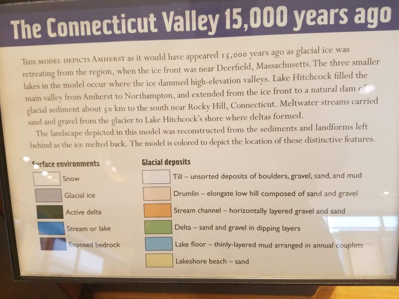
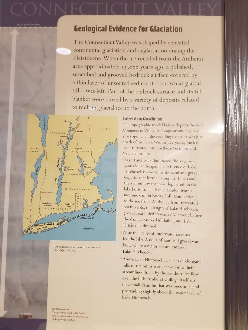
The primary reason that I wanted to come to this museum is that I had read about the display they had about local geology, in particular regarding the Connecticut River valley and the glaciation effects in the region.
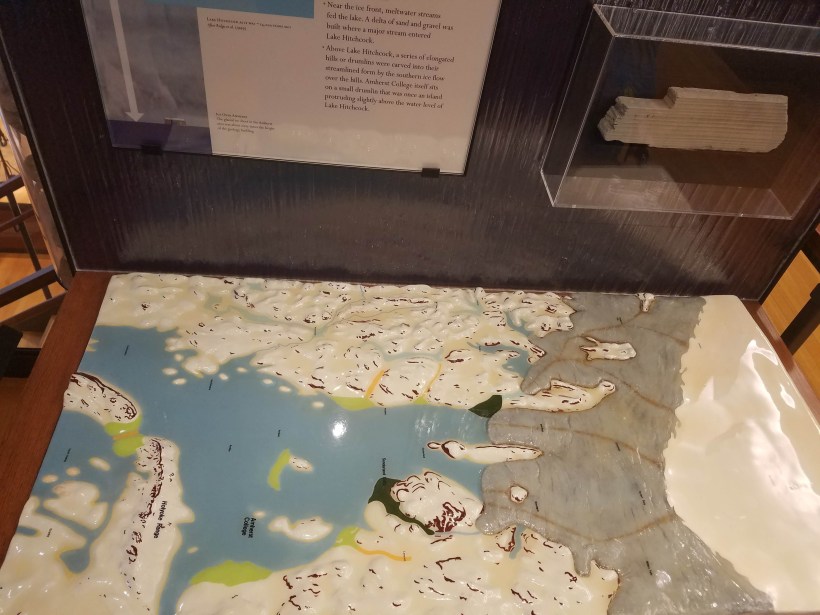
The glacial ice that extended down from Canada during the most recent ice age glacier advance pushed debris ahead of it all the way to Long Island Sound. Long Island itself marks the furthest extent of the ice southward in the New England region. As the ice slowly melted over the course of almost 4,000 years, various debris fields terminal moraines were left, causing the development of several lakes. The explanation in the photo above goes with the model shown below.
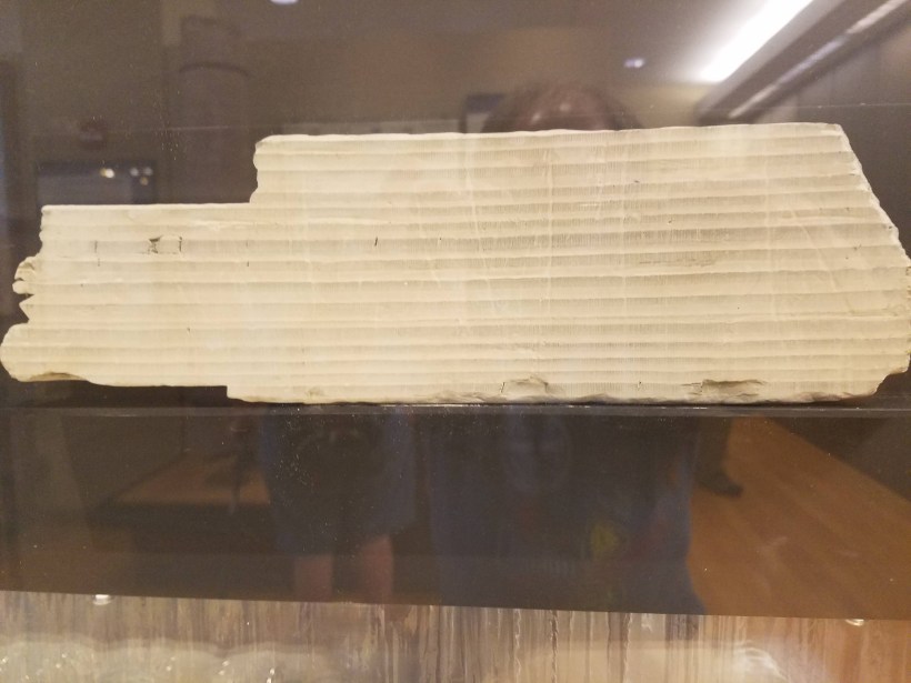
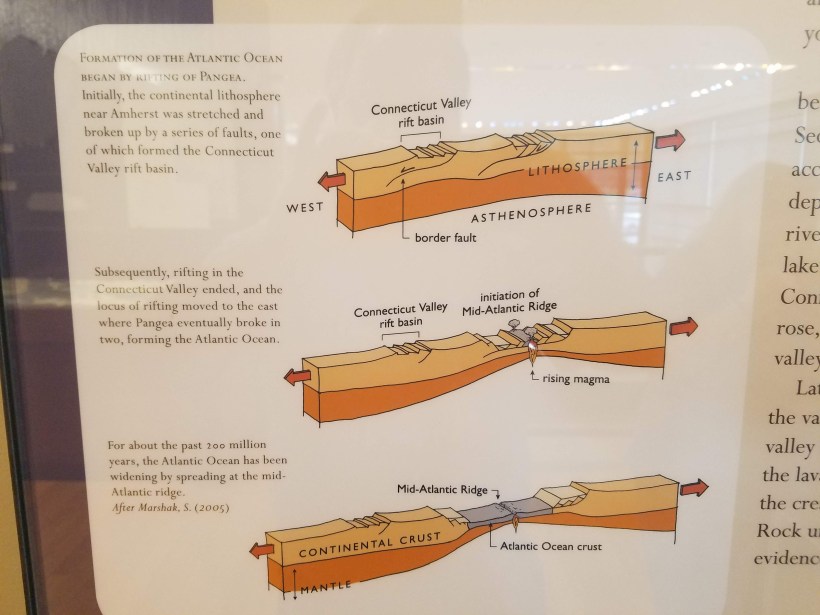
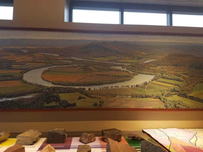
Edward Hitchcock mapped some of the varves such as those shown in this rock sample from Massachusetts. Varves are similar to tree rings in that each light/dark band represents one year of lake deposit. Also similar to tree rings, varves can be matched from locality to locality by comparing thickness patterns which represent climatic shifts.An interesting find is that some fossils found in New England east of the Connecticut River match the species of fossils found in Europe and Africa. This is evidence that when Pangea broke up 175 million years ago, the continental crust of New England got pulled apart from its counterparts in Europe and Africa as the Atlantic Ocean formed.As the future North American continent was breaking away from the future British Isles, Europe, and Africa, multiple rifts formed. One rift became the Connecticut river valley, another rift continued rifting and became the Atlantic Ocean.There was a nice 3D geologic map of the Amherst region, matched up with the views seen through the windows… … and the rock samples on the display next to the map.
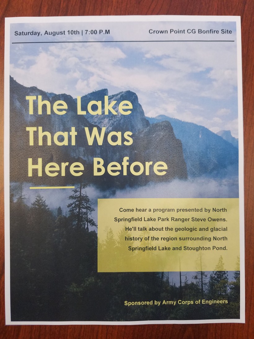
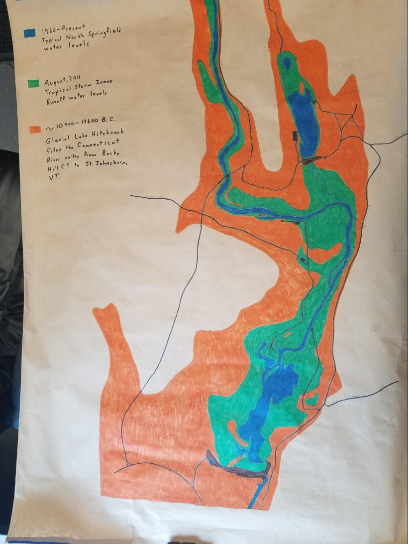
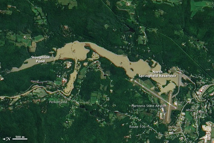
I have a campfire program scheduled to present at Crown Point Campground (a private campground near the North Springfield Lake and Stoughton Pond Recreation Area where I currently work) this Saturday, August 10. I’d appreciate your prayers for that!Using this map that I’ve drawn, I plan to relate the current lake and water levels (blue) to flooding which occurred here during Tropical Storm Irene in 2011 (green) and the local extent of glacial Lake Hitchcock (orange).Aerial view of the flooding from Tropical Storm Irene in 2011.Glacial Lake Hitchcock stretched from southern Connecticut to northern Vermont.