One of the things I really enjoyed doing for the California Trail Interpretive Center in Elko, NV was developing a mobile app for them. No, I’m not a programmer. I used an online product from STQRY.com that allows me to create the content and they take care of the back-end stuff.
I recently did something similar for Osceola History (the Osceola County Historical Society) in Kissimmee, FL. I’ve told you about the History Museum and Pioneer Village. Now here’s a description of the mobile app, available for free on the Apple and Google stores (search for “Osceola History”). There is also a web-based mirror site which you can browse located at https://ochs.stqry.app/1.
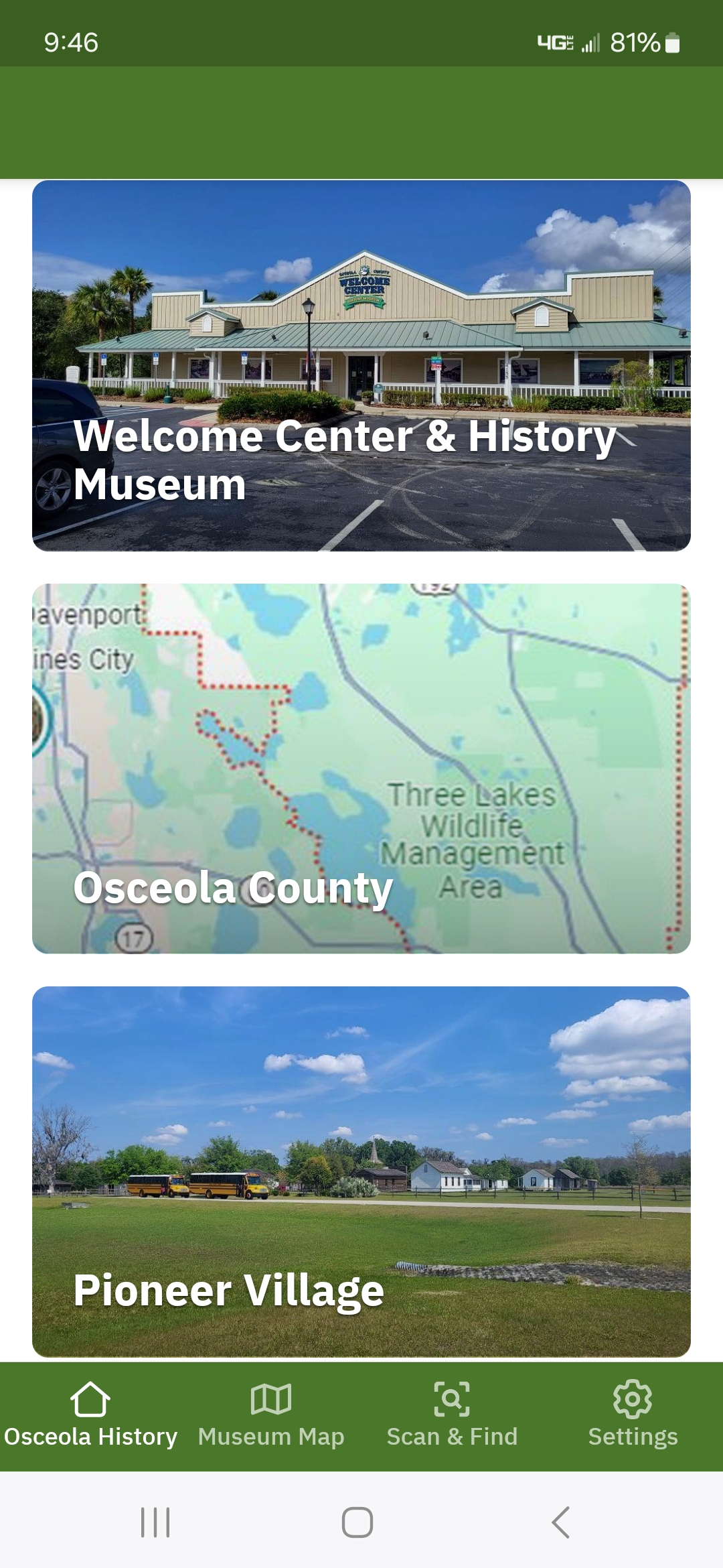
When you first open the app, you’ll see the three main sections – the Museum, Osceola County, and Pioneer Village – along with a few additional navigation buttons along the bottom. I’ll begin with those at the bottom. I’ve place a museum map in the app to help to illustrate how the museum is laid out along with a key to the various displays and interpretive panels.


The museum section has a couple of scavenger hunts based on the plants/animals and the historical photographs and objects.

There is also the option to do a full 3-D tour walk-through of the museum, which I shared here before and can be accessed at https://my.matterport.com/show/?m=2HhyKfoyfKA. While in the museum, you have the opportunity to scan various QR codes to view additional digital content. For example, you can listen to an audio tour as you browse the displays. You can view primary source documents (if available digitally) for some of the quotes and images found on the interpretive panels. You can view slide shows related to the natural history of the county, view videos related to the content, and listen to a few sounds produced by some of the wildlife in the region.
The Osceola County section is focused on getting you out and about in the county. The first section highlights quite a few of the historical markers and interpretive sites, showing photos and maps to help you locate them.

Similarly, you can take a walking tour through one of the local historic cemeteries where many of the original settlers in the area are buried. There is also a map and descriptions of the locations of wildlife conservation areas across the county which are referenced in the museum.
The final section – Pioneer Village – is still under development. The app was originally planned to tie in with a grant application that we submitted for the History Museum. The grant did not get approved, but I received permission from the Historical Society to proceed with the app development anyway. That’s why the app focuses right now on the museum.
The app won’t mean much to you unless you’re able to come visit our sites in Florida. But perhaps I’ve whetted your appetite enough through these last “in-between the Life of Paul” blog posts that you can stop by and see us!
